
IMAGES TAKEN NEAR TO
Hurn Road, CHRISTCHURCH, BH23 2RJ
Introduction
This page details the photographs taken nearby to Hurn Road, BH23 2RJ by members of the Geograph project.
The Geograph project started in 2005 with the aim of publishing, organising and preserving representative images for every square kilometre of Great Britain, Ireland and the Isle of Man.

There are currently over 7.5m images from over14,400 individuals and you can help contribute to the project by visiting https://www.geograph.org.uk
Image Map
Images are licensed for reuse under creativecommons.org/licenses/by-sa/2.0
Notes
- Clicking on the map will re-center to the selected point.
- The higher the marker number, the further away the image location is from the centre of the postcode.
Image Listing (21 Images Found)
Images are licensed for reuse under creativecommons.org/licenses/by-sa/2.0
Image
Details
Distance
1
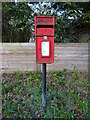
Elizabeth II postbox on Hurn Road
Postbox No. BH23 106.
Image: © JThomas
Taken: 23 Mar 2022
0.02 miles
2
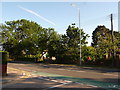
Fairmile: postbox № BH23 106, Hurn Road
A small postbox which looks up Sandy Lane, emptied at 5:30pm on weekdays and at noon on Saturdays.
Image: © Chris Downer
Taken: 16 Jun 2009
0.03 miles
3
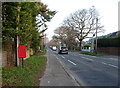
Hurn Road (B3073)
Showing position of Postbox No. BH23 106.
Image: © JThomas
Taken: 23 Mar 2022
0.04 miles
4
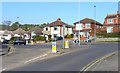
Roundabout at The Grove
This busy junction is at the north end of The Grove. To the right, the B3073 is known as Fairmile Road, whilst to the left, the continuing B3073 is called Hurn Road.
Image: © mike smith
Taken: 3 Mar 2011
0.06 miles
5
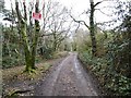
St. Catherine's Hill Lane
Bridleway from Fairmile Road up the hill, and on to Avon Causeway.
Image: © Mike Faherty
Taken: 14 Feb 2015
0.14 miles
6
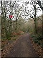
Track, St Catherine's Hill
Track leading from Fairmile Road to the top of the hill, and on to Avon Causeway. The topography of the hill is well described at http://www.south-coast-central.co.uk/n&q/stcatherineshill.htm
Image: © Mike Faherty
Taken: 26 Nov 2008
0.15 miles
7
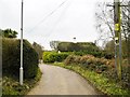
St. Catherine's Hill, Little Oaks Cottage
Thatched cottage on St. Catherine's Hill Lane.
Image: © Mike Faherty
Taken: 14 Feb 2015
0.16 miles
8

Fairmile Road, Christchurch
Fairmile Road, in the suburbs of Christchurch, is on the route of the B3073 as it heads out of the town.
Image: © Malc McDonald
Taken: 12 Apr 2025
0.16 miles
9

Pine needles
Hillside and path deep in pine needles on St. Catherine’s Hill.
Image: © David Martin
Taken: 22 Jan 2022
0.17 miles
10

Hillside Drive, Christchurch
Hillside Drive is a minor residential road in St. Catherine's Hill, a district in the town of Christchurch.
Image: © Malc McDonald
Taken: 12 Apr 2025
0.17 miles