1
Crooked Beam restaurant near Jumpers
Image: © John Firth
Taken: 13 May 2010
0.02 miles
2
Bournemouth : Barrack Road
Barrack Road has an Esso Petrol Station
Image: © Lewis Clarke
Taken: 6 Jun 2008
0.05 miles
3
Old tramway box
An old cast iron roadside circuit box, probably a remnant from the tramway although this is a different design to that at County Gates.
Image: © Mat Tuck
Taken: 1 Dec 2013
0.06 miles
4
Direction Sign - Signpost by the A35, Barrack Road, Christchurch
Annulus finial - 4 arms; Hampshire Parish halo by the A35, in parish of Christchurch (Christchurch District), Barrack Road, junction with The Grove, at centre of Jumpers Roundabout.
Surveyed
Milestone Society National ID: HA_SZ1493
Image: © Milestone Society
Taken: Unknown
0.07 miles
5
Jumpers: postbox № BH23 58, Barrack Road
Looking across Barrack Road to the corner of Jumpers Avenue, where this well-painted George V-reign postbox catches the last of the evening sun before it falls into the shadow of the Esso garage/Tesco Express to the left. The box is emptied finally at 5:30pm on weekdays and at noon on Saturdays.
Image: © Chris Downer
Taken: 16 Jun 2009
0.08 miles
6
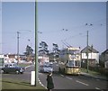
Bournemouth trolleybus at Jumpers Corner (2)
Sunbeam MF2B trolleybus 299 (299 LJ) on route 20 to Bournemouth taken in Barrack Road at the junction with Stourvale Avenue. The vehicle dates from 1962 and has Weymann 65-seater bodywork, it being one of the last batch of trolleybuses delivered to Bournemouth Corporation Transport, only to see less than seven years service in that town.
Image: © David Hillas
Taken: 5 Apr 1969
0.09 miles
7
George V postbox on Barrack Road
Postbox No. BH23 58.
Image: © JThomas
Taken: 23 Mar 2022
0.09 miles
8
The Stourvale public house
Image: © JThomas
Taken: 23 Mar 2022
0.10 miles
9
The Stourvale
A Marstons pub on Barrack Road. The A35 heading into Christchurch.
Image: © David Lally
Taken: 21 Mar 2010
0.11 miles
10
Christchurch, The Stourvale
Edwardian-looking pub on Barrack Road. Internally, central oval bar, drinking & eating areas on three sides, pool & TV to left. Cask ales on offer at my visit: Jenning's Sneck-Lifter, Ringwood Best. For some customer reviews, see http://www.beerintheevening.com/pubs/s/23/2325/Stourvale/Christchurch
Image: © Mike Faherty
Taken: 4 Feb 2009
0.11 miles


