
IMAGES TAKEN NEAR TO
Kings Avenue, CHRISTCHURCH, BH23 1NN
Introduction
This page details the photographs taken nearby to Kings Avenue, BH23 1NN by members of the Geograph project.
The Geograph project started in 2005 with the aim of publishing, organising and preserving representative images for every square kilometre of Great Britain, Ireland and the Isle of Man.

There are currently over 7.5m images from over14,400 individuals and you can help contribute to the project by visiting https://www.geograph.org.uk
Image Map
Images are licensed for reuse under creativecommons.org/licenses/by-sa/2.0
Notes
- Clicking on the map will re-center to the selected point.
- The higher the marker number, the further away the image location is from the centre of the postcode.
Image Listing (50 Images Found)
Images are licensed for reuse under creativecommons.org/licenses/by-sa/2.0
Image
Details
Distance
1
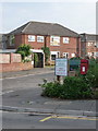
Christchurch: postbox № BH23 82, King?s Avenue
A small postbox, emptied finally at 5:30pm on weekdays and at 12:30pm on Saturdays.
Image: © Chris Downer
Taken: 30 Jun 2009
0.05 miles
2
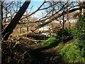
Christchurch: arrival at the River Stour
This deceptively rural-feeling public footpath comes from Stour Road (Image) to arrive here at the riverbank. The trunk of a fallen tree separates our view of a boat and its reflection. The path doesn't extend in either direction alongside the river, so we can now only turn back.
Image: © Chris Downer
Taken: 17 Feb 2018
0.07 miles
3
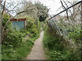
Christchurch, footpath
Path from Fairway Drive to a secluded creek on the River Stour; flats in Fairway Drive to the right.
Image: © Mike Faherty
Taken: 5 May 2010
0.09 miles
4
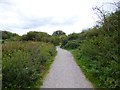
Iford, track
Through scrubland parallel to River Stour, from Iford to Tuckton.
Image: © Mike Faherty
Taken: 11 Sep 2012
0.09 miles
5
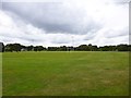
Iford Playing Fields
Rugby and football pitches, between Iford Lane and River Stour. http://www.bournemouth.gov.uk/LeisureCultureLibraries/Parks/Thingstodoandplacestogo/PlaygroundsandFacilities/Playgroundsandfacilitiesforteenagers.aspx#iford
Image: © Mike Faherty
Taken: 11 Sep 2012
0.10 miles
6
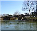
Christchurch, railway bridge
Carrying the Bournemouth to Southampton railway lines across River Stour.
Image: © Mike Faherty
Taken: 6 Apr 2013
0.10 miles
7
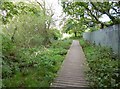
Iford Meadows, boardwalk
Across boggy land; Network Rail land to the right. http://www.bournemouth.gov.uk/LeisureCultureLibraries/Parks/Bournemouths-Countryside/LocalNatureReserves/IfordMeadowsLocalNatureReserve.aspx
Image: © Mike Faherty
Taken: 11 Sep 2012
0.11 miles
8
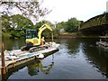
Iford, bridge works
The current of the River Stour has been causing damage to the piers of the railway bridge to the right, on the Bournemouth to Christchurch line; gravel temporarily deposited as a shield is being removed before further work takes place.
Image: © Mike Faherty
Taken: 23 Aug 2012
0.11 miles
9
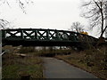
Iford: path under the railway at Iford Meadows
The main London to Weymouth railway line crosses the River Stour (to our right) and then immediately passes at a low level across the meadows to the west of the river. In doing so, it splits the Iford Playing Fields (this side) from Iford Meadows local nature reserve (ahead).
The line was closed for engineering work this weekend and we can see a large yellow vehicle, part of the said works, going about some business or other on the tracks above us.
Image: © Chris Downer
Taken: 5 Jan 2019
0.13 miles
10
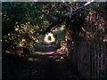
Christchurch: public footpath to the riverbank
This public footpath from Stour Road suddenly leaves behind a modern side-road alongside it and has a rural feel. It doesn't go very far - just to the riverbank with no access in either direction once there.
Image: © Chris Downer
Taken: 17 Feb 2018
0.15 miles