
IMAGES TAKEN NEAR TO
Wickfield Avenue, CHRISTCHURCH, BH23 1JA
Introduction
This page details the photographs taken nearby to Wickfield Avenue, BH23 1JA by members of the Geograph project.
The Geograph project started in 2005 with the aim of publishing, organising and preserving representative images for every square kilometre of Great Britain, Ireland and the Isle of Man.

There are currently over 7.5m images from over14,400 individuals and you can help contribute to the project by visiting https://www.geograph.org.uk
Image Map
Images are licensed for reuse under creativecommons.org/licenses/by-sa/2.0
Notes
- Clicking on the map will re-center to the selected point.
- The higher the marker number, the further away the image location is from the centre of the postcode.
Image Listing (316 Images Found)
Images are licensed for reuse under creativecommons.org/licenses/by-sa/2.0
Image
Details
Distance
1
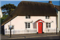
Buildings of Christchurch (a selection): 56 Sopers Lane
C18/early C19 cottage with a thatched roof. Listed Grade II.
https://historicengland.org.uk/listing/the-list/list-entry/1110051
Image: © Mike Searle
Taken: 17 May 2014
0.06 miles
2
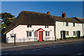
Buildings of Christchurch (a selection): 56 - 60 Sopers Lane
A mixed terrace of three C18 or early C19 cottages, with no. 56 having a thatched roof, no. 58 is slate, whilst no. 60 is tiled.
Image: © Mike Searle
Taken: 17 May 2014
0.06 miles
3
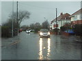
Christchurch: driving through floodwater in St. Margaret?s Avenue
I await my turn as St. Margaret's Avenue is reduced to single-file traffic thanks to flooding after a couple of weeks of persistent heavy rain.
Image: © Chris Downer
Taken: 4 Jan 2014
0.06 miles
4
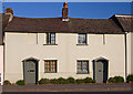
Buildings of Christchurch (a selection): 58 & 60 Sopers Lane
A pair of late C18/early C19 cottages. Listed Grade II.
https://historicengland.org.uk/listing/the-list/list-entry/1303833
Image: © Mike Searle
Taken: 17 May 2014
0.06 miles
5
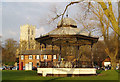
Christchurch Priory church and Bandstand
The Priory has a remarkable history. www.christchurchpriory.org
The bandstand is Victorian !
Image: © Nigel Freeman
Taken: Unknown
0.07 miles
7
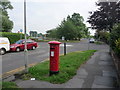
Christchurch: postbox № BH23 55, Wick Lane
A George VI-reign postbox, with advertised final collections at 5:30pm on weekdays and at 12:30pm on Saturdays.
Image: © Chris Downer
Taken: 30 Jun 2009
0.09 miles
8
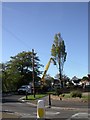
Christchurch, Lombardy Poplar
Tree surgeons in the process of cutting down a decaying poplar tree in Wick Lane. The tree is about 30m high, and was probably planted in the 1940s; it is now considered a danger to nearby pedestrians, properties and traffic.
Image: © Mike Faherty
Taken: 21 Oct 2010
0.10 miles
9
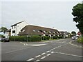
Whitehall, Christchurch
Whitehall is a residential road in Christchurch. It is on the route of National Cycle Network route 2.
Image: © Malc McDonald
Taken: 20 Aug 2021
0.10 miles
10
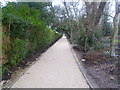
Christchurch, Creedy Path
Path from Wick Lane to Sopers Lane, running through Druitt Gardens. Like the gardens (to the right), the path is being refurbished. According to a poster, this is one of Christchurch's oldest paths, which probably once connected the priory and a leper hospital off Barrack Road. It seems that the path will in future also be used by cyclists: http://www.dorsetecho.co.uk/archive/2011/06/19/Latest+News+(be_latest+news)/9092355.Cyclists_on_road_to_success/
Image: © Mike Faherty
Taken: 1 Jan 2012
0.10 miles