
IMAGES TAKEN NEAR TO
Wimborne Road East, FERNDOWN, BH22 9NN
Introduction
This page details the photographs taken nearby to Wimborne Road East, BH22 9NN by members of the Geograph project.
The Geograph project started in 2005 with the aim of publishing, organising and preserving representative images for every square kilometre of Great Britain, Ireland and the Isle of Man.

There are currently over 7.5m images from over14,400 individuals and you can help contribute to the project by visiting https://www.geograph.org.uk
Image Map
Images are licensed for reuse under creativecommons.org/licenses/by-sa/2.0
Notes
- Clicking on the map will re-center to the selected point.
- The higher the marker number, the further away the image location is from the centre of the postcode.
Image Listing (21 Images Found)
Images are licensed for reuse under creativecommons.org/licenses/by-sa/2.0
Image
Details
Distance
1
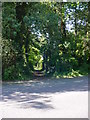
Old Trackway East Dorset
This is a view from the Wimborne Road near Trickett's Cross of the old trackway that once ran from Dudsbury hill fort on the River Stour, across the heathland of this part of Dorset and onto the hinterland of north Dorset and Wiltshire. It was undoubtedly used by smugglers for a time.
Image: © Martin Rowley
Taken: 24 Jul 2012
0.03 miles
2
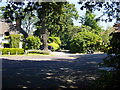
Old Trackway and 'Smugglers' Cottage, Trickett's Cross
A view of an ancient trackway that once ran from the banks of the River Stour (Dudsbury hill fort) across the heathland and on into north Dorset and Wiltshire. The cottage on the left of the lane is known as 'Smugglers Cottage', and parts of it are thought to be over 400 years old. The trackway was almost certainly used to take contraband away from the coastal area in the south to 'customers' inland. The road in the foreground is the Wimborne Road, once a turnpike linking that town with Ringwood.
Image: © Martin Rowley
Taken: 24 Jul 2012
0.06 miles
3
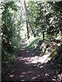
Ancient trackway in East Dorset
This image, roughly halfway between the busy Wimborne Road and the even busier Ringwood Road (A347), both former turnpikes of late 18th century vintage, shows the 'true' nature of the track that might have been familiar to folk using the way over a couple of centuries ago. I doubt the trees would have been so developed - the track would have passed across a heathland landscape and the shrubbery would have been cropped by ponies, cattle & wild animals etc.
Image: © Martin Rowley
Taken: 24 Jul 2012
0.07 miles
5
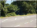
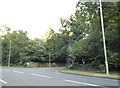
Ancient trackway heading NNE in East Dorset
Lost in the encroaching greenery is the continuation of a once ancient trackway that stretched from Dudsbury hill fort on the River Stour, towards St. Leonard's Common (West Moors) and then on north to Wiltshire and NE Dorset. The track is traceable on old maps of the 19th century. The road in the foreground is the A347 (Ringwood Road) which was very busy - it was quite a feat to capture this with nothing on it!
Image: © Martin Rowley
Taken: 24 Jul 2012
0.10 miles
6
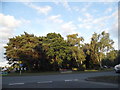
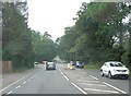
Roundabout at the end of Wimborne Road East
Image: © David Howard
Taken: 3 Jul 2017
0.11 miles
7
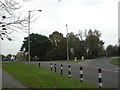
Trickett's Cross Roundabout
At the junction of Ringwood Road (A348) and Wimborne Road East.
Image: © Mike Faherty
Taken: 27 Nov 2010
0.11 miles
8
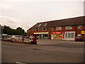
Ferndown: postbox № BH22 96, Turbary Road
Turbary Road is the access road for a large housing estate which comprises a mix of council housing and desirable bungalows. Here, by the junction with the main road, are shops including a general store (round to the left), fish & chip shop, off licence and (out of picture, right) Chinese takeaway. The postbox, like the three in the estate, is emptied finally at 5:15pm on weekdays and at 12:30pm on Saturdays.
For many years residents of the estate campaigned for a post office, since it's quite a distance into Ferndown town from here – but they never got one.
Image: © Chris Downer
Taken: 8 Jun 2009
0.12 miles
10
New Houses, Badgers Walk, Ferndown
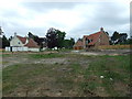
Situated behind us there is a large area of woodland called 'The Warren', which has been cleared and earmarked for development.
Image: © Lorraine and Keith Bowdler
Taken: 23 May 2011
0.14 miles