Ancient trackway in East Dorset
Introduction
The photograph on this page of Ancient trackway in East Dorset by Martin Rowley as part of the Geograph project.
The Geograph project started in 2005 with the aim of publishing, organising and preserving representative images for every square kilometre of Great Britain, Ireland and the Isle of Man.

There are currently over 7.5m images from over 14,400 individuals and you can help contribute to the project by visiting https://www.geograph.org.uk
Ancient trackway in East Dorset
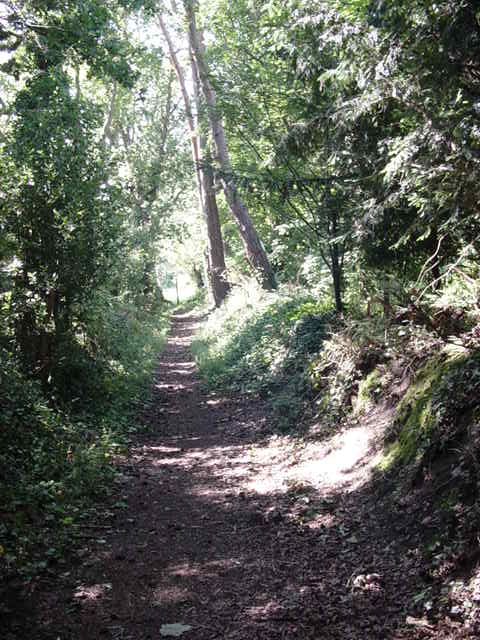
Image: © Martin Rowley Taken: 24 Jul 2012
This image, roughly halfway between the busy Wimborne Road and the even busier Ringwood Road (A347), both former turnpikes of late 18th century vintage, shows the 'true' nature of the track that might have been familiar to folk using the way over a couple of centuries ago. I doubt the trees would have been so developed - the track would have passed across a heathland landscape and the shrubbery would have been cropped by ponies, cattle & wild animals etc.
Images are licensed for reuse under creativecommons.org/licenses/by-sa/2.0
Image Location
Latitude
50.808582
Longitude
-1.880164