
IMAGES TAKEN NEAR TO
Holt Forest, WIMBORNE, BH21 7BT
Introduction
This page details the photographs taken nearby to Holt Forest, BH21 7BT by members of the Geograph project.
The Geograph project started in 2005 with the aim of publishing, organising and preserving representative images for every square kilometre of Great Britain, Ireland and the Isle of Man.

There are currently over 7.5m images from over14,400 individuals and you can help contribute to the project by visiting https://www.geograph.org.uk
Image Map
Images are licensed for reuse under creativecommons.org/licenses/by-sa/2.0
Notes
- Clicking on the map will re-center to the selected point.
- The higher the marker number, the further away the image location is from the centre of the postcode.
Image Listing (11 Images Found)
Images are licensed for reuse under creativecommons.org/licenses/by-sa/2.0
Image
Details
Distance
1
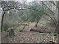
Footbridge, Holt Forest
Small two sleeper bridge, across a stream.
Image: © Lorraine and Keith Bowdler
Taken: 17 Jan 2012
0.05 miles
2
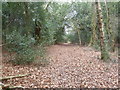
Holt Forest, footpath
Through, in this part of the National Trust-owned woodland, dense holly.
Image: © Mike Faherty
Taken: 16 Feb 2012
0.14 miles

5
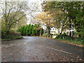
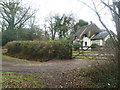
Holt: junction at Plantation House
The property Plantation House is set behind a line of evergreen shrubs while autumn is evident all around.
Image: © Chris Downer
Taken: 8 Nov 2008
0.16 miles
6

Holt Forest, country road
From Broad Lawn to Chalbury Common.
Image: © Mike Faherty
Taken: 16 May 2013
0.16 miles
7
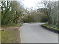
Holt Wood, road junction
Coming from Holt Wood: ahead to Lower Row, right to Holt.
Image: © Mike Faherty
Taken: 16 Feb 2012
0.16 miles
9

Holt Forest, path
Entering the National Trust's nature reserve: http://www.holtparishcouncil.btck.co.uk/
Image: © Mike Faherty
Taken: 16 May 2013
0.23 miles
10

Holt, gateway
On the bridleway towards Ferndown Forest; also marking the beginning of National Trust land.
Image: © Mike Faherty
Taken: 11 Jul 2020
0.25 miles