
IMAGES TAKEN NEAR TO
Cranborne, WIMBORNE, BH21 5RY
Introduction
This page details the photographs taken nearby to BH21 5RY by members of the Geograph project.
The Geograph project started in 2005 with the aim of publishing, organising and preserving representative images for every square kilometre of Great Britain, Ireland and the Isle of Man.

There are currently over 7.5m images from over14,400 individuals and you can help contribute to the project by visiting https://www.geograph.org.uk
Image Map
Images are licensed for reuse under creativecommons.org/licenses/by-sa/2.0
Notes
- Clicking on the map will re-center to the selected point.
- The higher the marker number, the further away the image location is from the centre of the postcode.
Image Listing (6 Images Found)
Images are licensed for reuse under creativecommons.org/licenses/by-sa/2.0
Image
Details
Distance
1
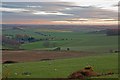
West Blagdon Farm
Sheep grazing after a day of rain.
Image: © Simon Barnes
Taken: 6 Jan 2007
0.08 miles
2

Cranborne: a lone horse and a lone tree
There is a bit of licence in the title to this image - if you zoom out a bit Image you'll see that the tree does actually have another nearby.
Image: © Chris Downer
Taken: 8 Feb 2015
0.11 miles
3
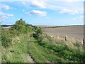
Bridleway between Cranborne and Pentridge
This is a broad well used Bridleway through the large arable fields of the Cranborne Estate.The wheat has not yet been harvested.
Image: © Clive Perrin
Taken: 29 Aug 2005
0.14 miles
4

Cranborne: zigzaggy fences of West Blagdon Farm
Looking down from Pentridge Farm over the various field boundaries on the eastern slopes of the hill.
Image: © Chris Downer
Taken: 8 Feb 2015
0.16 miles
5

Cranborne: the fields of West Blagdon Farm
Looking southeast from the top of Pentridge Hill.
Image: © Chris Downer
Taken: 8 Feb 2015
0.25 miles
6
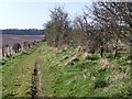
Bridleway, Blackbush Down
The bridleway takes riders and walkers from Pentridge Down to Cranborne, it is part of the Jubilee Trail.
Image: © Maigheach-gheal
Taken: 17 Mar 2009
0.25 miles