
IMAGES TAKEN NEAR TO
High Street, WIMBORNE, BH21 4BA
Introduction
This page details the photographs taken nearby to High Street, BH21 4BA by members of the Geograph project.
The Geograph project started in 2005 with the aim of publishing, organising and preserving representative images for every square kilometre of Great Britain, Ireland and the Isle of Man.

There are currently over 7.5m images from over14,400 individuals and you can help contribute to the project by visiting https://www.geograph.org.uk
Image Map
Images are licensed for reuse under creativecommons.org/licenses/by-sa/2.0
Notes
- Clicking on the map will re-center to the selected point.
- The higher the marker number, the further away the image location is from the centre of the postcode.
Image Listing (130 Images Found)
Images are licensed for reuse under creativecommons.org/licenses/by-sa/2.0
Image
Details
Distance
1
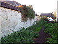
Footpath, Sturminster Marshall
The footpath is part of the Wareham Forest Way.
The route takes walkers from Wareham to Sturminster Marshall, taking in some of the less well known landscapes of north Purbeck and East Dorset. The route is 20.5 km.
Image: © Maigheach-gheal
Taken: 27 Nov 2011
0.01 miles
2
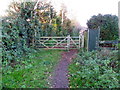
Gates, Sturminster Marshall
Looking back at the gate that has given us access to the next part of our walk along the Wareham Forest Way.
Image: © Maigheach-gheal
Taken: 27 Nov 2011
0.02 miles
4
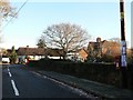
Sturminster Marshall: postbox № BH21 22, King?s Street
This little postbox is emptied finally at 4:30pm on weekdays and at 8:45am on Saturdays. In the distance are Image
Image: © Chris Downer
Taken: 7 Dec 2008
0.04 miles
5
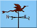
Weather vane, Sturminster Marshall
The word 'vane' comes from the Anglo-Saxon word 'fane', meaning 'flag'. Originally, fabric pennants would show archers the direction of the wind. Later, the cloth flags were replaced by metal ones, decorated with the nobleman's coat of arms. It was understood that shifts in the wind often indicated changes in the weather. Cardinal points were not added until several centuries later.
Image: © Maigheach-gheal
Taken: 25 Jun 2011
0.04 miles
6
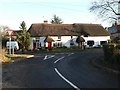
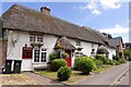
Sturminster Marshall: thatched cottages, High Street
A handsome pair of thatched cottages, 148 and 150 High Street.
Image: © Chris Downer
Taken: 7 Dec 2008
0.04 miles
7
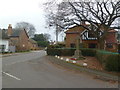
Sturminster Marshall, war memorial
At the corner of High and Kings Street; recording the deaths of 21 fallen in WWI and 8 in WWII.
Image: © Mike Faherty
Taken: 17 Jan 2012
0.04 miles
8
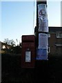
Sturminster Marshall: Christmassy notices
Among the advertised activities alongside Image is a meeting with Santa and his reindeer.
Image: © Chris Downer
Taken: 7 Dec 2008
0.05 miles
9
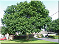
Oak tree, Sturminster Marshall
The tree was planted in 1887 to celebrate the Golden Jubilee of Queen Victoria's accession to the throne.
Image: © Maigheach-gheal
Taken: 25 Jun 2011
0.06 miles
10
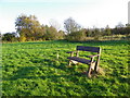
Seat, Sturminster Marshall
Beside the Wareham Forest Way is this very comfortable seat.
Image: © Maigheach-gheal
Taken: 27 Nov 2011
0.06 miles