
IMAGES TAKEN NEAR TO
Wayman Road, WIMBORNE, BH21 3PL
Introduction
This page details the photographs taken nearby to Wayman Road, BH21 3PL by members of the Geograph project.
The Geograph project started in 2005 with the aim of publishing, organising and preserving representative images for every square kilometre of Great Britain, Ireland and the Isle of Man.

There are currently over 7.5m images from over14,400 individuals and you can help contribute to the project by visiting https://www.geograph.org.uk
Image Map
Images are licensed for reuse under creativecommons.org/licenses/by-sa/2.0
Notes
- Clicking on the map will re-center to the selected point.
- The higher the marker number, the further away the image location is from the centre of the postcode.
Image Listing (22 Images Found)
Images are licensed for reuse under creativecommons.org/licenses/by-sa/2.0
Image
Details
Distance
1
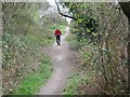
Roman Road in Broadstone
To the left is Corfe Hills school playing field, to the right dense housing in Corfe Mullen. Just to the right is the aggar of the Roman Road. This is near the end of our 7 mile walk, and my feet are killing me.
Image: © John Palmer
Taken: 30 Mar 2009
0.09 miles
2
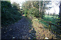
Turf Zone "Highcaster"
Track off Lancaster Drive, Corfe Mullen.
Image: © Ian S
Taken: 17 Nov 2022
0.10 miles
3
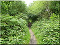
Broadstone, Roman road
From Lake, by Hamworthy, to Badbury, and then on to Bath. Part of the ager embankment can be seen in places, but at this time of year the route is overgrown. Much of the route in Poole is now a bridleway.
Image: © Mike Faherty
Taken: 24 Jun 2011
0.10 miles
4
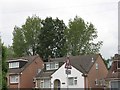
Poplars on Lancaster Drive
At the top of Lancaster Drive, 3 rare black poplars grow.
The two outer are female, the middle is male. We have successfully
grown cuttings from these rare trees
Image: © John Palmer
Taken: 17 May 2008
0.10 miles
5
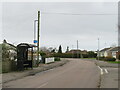
Highfield Road, Corfe Mullen
Highfield Road is a residential road in Corfe Mullen, near Poole.
Image: © Malc McDonald
Taken: 7 Feb 2022
0.11 miles
6
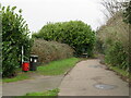
Roman Road, Broadstone
This path, on the edge of Broadstone, follows the route of a Roman road. The Roman road was reasonably short, running from the port at Hamworthy to a hill fort at Badbury Rings.
Image: © Malc McDonald
Taken: 7 Feb 2022
0.12 miles
7
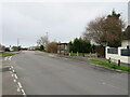
Lancaster Drive, Broadstone
Lancaster Drive is a minor road in Broadstone, on the outskirts of Poole. Notice that the road surface changes just beyond the bus stop. Here is the boundary between two unitary authorities, Bournemouth Christchurch & Poole (BCP) and Dorset.
Image: © Malc McDonald
Taken: 7 Feb 2022
0.13 miles
8
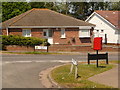
Broadstone: postbox № BH18 212, Lancaster Drive
This small postbox is right on the Poole borough boundary, the boundary being Roman Road, in which we are stood. The Roman Road sign in front of us is an East Dorset one; the Lancaster Drive signs beyond are those of Poole Borough.
The BH21 (Wimborne) area is to the left, with BH18 (Broadstone, part of Poole borough but postally separate) to the right. The postal boundary does not quite match the borough one all the way down Roman Road, thanks to short culs-de-sac off to the west which are obviously better served from the east.
The box is emptied at 5:30 on weekday evenings and at 11:45 on Saturday mornings.
Image: © Chris Downer
Taken: 24 May 2009
0.13 miles
9
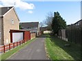
Alley in Corfe Mullen
At the end is an open grassy area. There used to be a kid's playground there,
until youths started playing there too, and the council had to remove the playground for children's safety.
Image: © John Palmer
Taken: 4 Apr 2009
0.15 miles
10
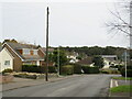
Lancaster Drive, Broadstone
Lancaster Drive is a residential road in Broadstone, on the outskirts of Poole.
Image: © Malc McDonald
Taken: 7 Feb 2022
0.15 miles