
IMAGES TAKEN NEAR TO
Middlefield, WAREHAM, BH20 6BA
Introduction
This page details the photographs taken nearby to Middlefield, BH20 6BA by members of the Geograph project.
The Geograph project started in 2005 with the aim of publishing, organising and preserving representative images for every square kilometre of Great Britain, Ireland and the Isle of Man.

There are currently over 7.5m images from over14,400 individuals and you can help contribute to the project by visiting https://www.geograph.org.uk
Image Map
Images are licensed for reuse under creativecommons.org/licenses/by-sa/2.0
Notes
- Clicking on the map will re-center to the selected point.
- The higher the marker number, the further away the image location is from the centre of the postcode.
Image Listing (15 Images Found)
Images are licensed for reuse under creativecommons.org/licenses/by-sa/2.0
Image
Details
Distance
1
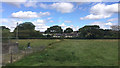
Houses at Binnegar
This part of Binnegar is between Wool and Wareham on the A352 (behind the hedge). On the left is part of a small sewage treatment works. Seen from a Weymouth-Waterloo train.
Image: © Robin Stott
Taken: 15 Aug 2017
0.04 miles
2
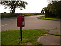
East Stoke: postbox № BH20 73, Binnegar
East Stoke is a large parish consisting of several hamlets, such as here at Binnegar. The postbox stands on the corner of Middlefield and is emptied finally at 4pm on weekdays and at 9am on Saturdays.
Image: © Chris Downer
Taken: 25 Jul 2009
0.04 miles
3
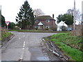
Road Junction at Binnegar
This is where the minor road from Rushton just to the south meets the A352 just after having crossed the level crossing on the Dorchester to Wareham line.
Image: © Nigel Mykura
Taken: 1 Feb 2013
0.09 miles
4
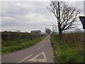
Road to Rushton
There is a level crossing, marked on some maps as Rushton Cottage Crossing
Image: © David Smith
Taken: 30 Mar 2017
0.11 miles
5
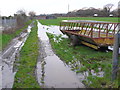
Waterlogged Field
This waterlogged field is sandwiched in between the Dorchester to Wareham railway which can be seen on the left and the A352 Dorchester to Wareham road which can be seen on the right.
Image: © Nigel Mykura
Taken: 1 Feb 2013
0.11 miles
6

Dorchester to Weymouth Railway
Looking west along the track from the small manually operated level crossing at Binnegar on the minor road to Rushton
Image: © Nigel Mykura
Taken: 1 Feb 2013
0.12 miles
7
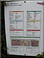
Level Crossing Sign
This sign gives full details of Access point No.25, the Rushton No.2 Level Crossing
Image: © Nigel Mykura
Taken: 1 Feb 2013
0.15 miles
8

East Stoke: straight to church
A straight section of the A352 leads the eye to the Image
Image: © Chris Downer
Taken: Unknown
0.16 miles
9
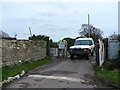
Rushton No.2 Level Crossing
This is an unmanned crossing where the vehicle driver has to operate the gates him or herself as these people in the Range Rover were doing..
Image: © Nigel Mykura
Taken: 1 Feb 2013
0.16 miles
