
IMAGES TAKEN NEAR TO
Gover Close, WAREHAM, BH20 5BU
Introduction
This page details the photographs taken nearby to Gover Close, BH20 5BU by members of the Geograph project.
The Geograph project started in 2005 with the aim of publishing, organising and preserving representative images for every square kilometre of Great Britain, Ireland and the Isle of Man.

There are currently over 7.5m images from over14,400 individuals and you can help contribute to the project by visiting https://www.geograph.org.uk
Image Map
Images are licensed for reuse under creativecommons.org/licenses/by-sa/2.0
Notes
- Clicking on the map will re-center to the selected point.
- The higher the marker number, the further away the image location is from the centre of the postcode.
Image Listing (20 Images Found)
Images are licensed for reuse under creativecommons.org/licenses/by-sa/2.0
Image
Details
Distance
1

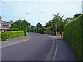
Old Kiln Road, Ridge, Dorset
This road was built on the site of the Wareham cement works, owned by the Dorset Portland Cement Company Ltd. It operated from 1875 to 1922. The kilns in question (of which there were five) were on the site of the houses at the far end, on the right. For more details, see [http://www.cementkilns.co.uk/cement_kiln_wareham.html].
Image: © Dylan Moore
Taken: 29 Jul 2010
0.06 miles
3
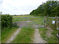
Ridge, gates
Opening onto access land and cattle grazing.
Image: © Mike Faherty
Taken: 25 Jun 2013
0.07 miles
4

NEW
Old Kiln Road, Ridge, near Wareham
Old Kiln Road is a minor residential road in Ridge, a hamlet in Dorset.
Image: © Malc McDonald
Taken: 24 Aug 2026
0.07 miles
5
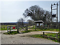
Course of Pike's Tramway, Ridge
Passing to the left of the shelter, this hauled clay from Creech and Furzebrook to a wharf on the River Frome from 1830 until 1957. It was regauged from probably 4' to 2'8.5" in 1866, and made suitable for locomotive haulage. This section is now used by the 'Poole Harbour Trail'.
Image: © Robin Webster
Taken: 1 Apr 2018
0.08 miles
6
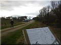
The car park for Stoborough Heath nature reserve
Image: © David Smith
Taken: 26 Jan 2018
0.11 miles
7

NEW
The Meerings, Ridge, near Wareham
The Meerings is a housing development in the hamlet of Ridge in Dorset.
Image: © Malc McDonald
Taken: 24 Aug 2026
0.11 miles
8
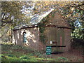
Ridge Engine Shed
This shed, near Ridge Wharf, was formerly used for the engines employed on the tramway that led to wharf from clay pits about three miles south. The tramway passed just to the left of the building.
Image: © David Squire
Taken: 3 Dec 2005
0.11 miles
9
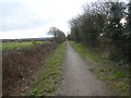
Old tramway route, now footpath
Part of the Poole Harbour Trail, this tramway was used for moving ball clay. It gives access to the nature reserve
Image: © David Smith
Taken: 26 Jan 2018
0.11 miles
10
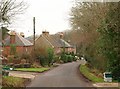
Barnhill Road, Ridge
Some of the older properties on this residential road in the village of Ridge. It's recycling collection day.
Image: © Derek Harper
Taken: 21 Jan 2010
0.12 miles