
IMAGES TAKEN NEAR TO
Palmerston Close, POOLE, BH16 5HH
Introduction
This page details the photographs taken nearby to Palmerston Close, BH16 5HH by members of the Geograph project.
The Geograph project started in 2005 with the aim of publishing, organising and preserving representative images for every square kilometre of Great Britain, Ireland and the Isle of Man.

There are currently over 7.5m images from over14,400 individuals and you can help contribute to the project by visiting https://www.geograph.org.uk
Image Map
Images are licensed for reuse under creativecommons.org/licenses/by-sa/2.0
Notes
- Clicking on the map will re-center to the selected point.
- The higher the marker number, the further away the image location is from the centre of the postcode.
Image Listing (21 Images Found)
Images are licensed for reuse under creativecommons.org/licenses/by-sa/2.0
Image
Details
Distance
1
Upton: postbox № BH16 376, Palmerston Road
This George V-reign postbox is currently missing its collection times plate. It stands on the corner of Upton Heath Estate.
Image: © Chris Downer
Taken: 15 Nov 2009
0.04 miles
2

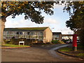
Upton : Poole Road Houses
A small access road and homes on Poole Road.
Image: © Lewis Clarke
Taken: 28 Oct 2017
0.08 miles
3
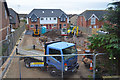
Upton : Construction Site
A small construction site seen off Poole Road.
Image: © Lewis Clarke
Taken: 28 Oct 2017
0.09 miles
4

Upton : Poole Road
Looking along Poole Road as it heads out from Upton.
Image: © Lewis Clarke
Taken: 28 Oct 2017
0.11 miles
5

Ropers Lane
This is an unmade up short residential road on the east side of Upton just south of the Poole Rd. This is the view north from close to the edge of the grid square.
Image: © Nigel Mykura
Taken: 29 Jul 2010
0.11 miles
6
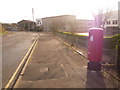
Upton: postbox № BH16 294, Factory Road
This modern postbox serves Upton Industrial Estate and is emptied at 5:30pm on weekdays and at noon on Saturdays.
Image: © Chris Downer
Taken: 15 Nov 2009
0.15 miles
7
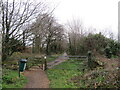
Upton Trailway, near Poole
Upton Trailway is a dismantled railway which is now used as a walking and cycling trail.
This image was taken on a dull February afternoon. Most of the trees were bare for the winter months.
Image: © Malc McDonald
Taken: 6 Feb 2022
0.19 miles
8
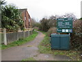
Upton Trailway, near Poole
Upton Trailway is a former railway route, now used as a cycling and walking path, at Upton near Poole.
Image: © Malc McDonald
Taken: 6 Feb 2022
0.20 miles

10
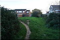
Turf Zone "BallamHeights"
Path off Dacombe Drive, Upton.
Image: © Ian S
Taken: 17 Nov 2022
0.21 miles