
IMAGES TAKEN NEAR TO
Mellstock Road, POOLE, BH15 3DW
Introduction
This page details the photographs taken nearby to Mellstock Road, BH15 3DW by members of the Geograph project.
The Geograph project started in 2005 with the aim of publishing, organising and preserving representative images for every square kilometre of Great Britain, Ireland and the Isle of Man.

There are currently over 7.5m images from over14,400 individuals and you can help contribute to the project by visiting https://www.geograph.org.uk
Image Map
Images are licensed for reuse under creativecommons.org/licenses/by-sa/2.0
Notes
- Clicking on the map will re-center to the selected point.
- The higher the marker number, the further away the image location is from the centre of the postcode.
Image Listing (34 Images Found)
Images are licensed for reuse under creativecommons.org/licenses/by-sa/2.0
Image
Details
Distance
1
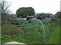
Longfleet, allotments
Tatnam Farm Allotments, off Sherrin Close. http://www.boroughofpoole.com/facilities/ref:F465e9bc7700ce/
Image: © Mike Faherty
Taken: 8 Nov 2009
0.06 miles
2

Defending Dorset in 1940: the Maiden Newton - Poole Harbour Stop Line (93)
-
Anti-tank Blocks: DoB ID: e24908
Poole - Tatnam Farm Allotments - Cubes. These anti-tank cubes in the allotments off Sherrin Close are a reminder that Poole was designated as an anti-tank island in 1940. There are over 30 "Dragon's Teeth" here, 6 have fallen, but around 20 are still upright, and they continue beyond into the grounds of St Mary's RC Church. These are the survivors of a continuous line that once extended from Poole Park to Creekmoor. The line went via Birds Hill Road and Garland Road, then north, before turning west along Sandbourne Road to join the anti-tank blocks here. The north of the town was an area that was considered particularly vulnerable, and accordingly where the defences were most concentrated.
Image
Image: © Mike Searle
Taken: 18 Feb 2016
0.06 miles
3

Defending Dorset in 1940: the Maiden Newton - Poole Harbour Stop Line (94)
-
Anti-tank Blocks: DoB ID: e24908
Poole - Tatnam Farm Allotments - Cubes. The line of anti-tank blocks extend from the boundary of the allotments beyond into the grounds of St Mary's RC Church, and once formed a continuous line from Poole Park to Creekmoor.
Image
Image: © Mike Searle
Taken: 18 Feb 2016
0.06 miles
4

Allotments in Oakdale
These are in Sherrin Close, by the Roman Catholic church.
Image: © mike smith
Taken: 9 Apr 2007
0.07 miles
5
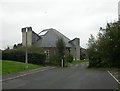
Longfleet, St. Mary's Church
Main entrance on Wimborne Road (Image), and North entrance on Sherrin Road (seen here). http://www.stmarysrcpoole.co.uk/
Image: © Mike Faherty
Taken: 8 Nov 2009
0.08 miles
6
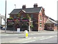
The New Inn
Stands between Wimborne Road and Fernside Road.
Image: © mike smith
Taken: 9 Apr 2007
0.10 miles
7
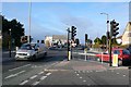
Wimborne Rd Poole
View north up the A35 Wimborne Rd from close to its junction with Fernside Rd.
Image: © Nigel Mykura
Taken: 14 Feb 2009
0.10 miles
8
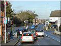
Poole, New Inn Junction
The traffic lights at the junction of Fernside Road (A35) with Wimborne Road (B3093).
Image: © David Dixon
Taken: 18 Dec 2012
0.10 miles
9

Turf Zone "CatholicMary"
St Mary's Church Hall on Wimborne Road, Poole.
Image: © Ian S
Taken: 16 Nov 2022
0.10 miles
10
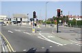
Road Junction in Oakdale
This is the junction of Wimborne Road, Fernside Road and Darby's Lane.
Image: © mike smith
Taken: 9 Apr 2007
0.11 miles