Defending Dorset in 1940: the Maiden Newton - Poole Harbour Stop Line (93)
Introduction
The photograph on this page of Defending Dorset in 1940: the Maiden Newton - Poole Harbour Stop Line (93) by Mike Searle as part of the Geograph project.
The Geograph project started in 2005 with the aim of publishing, organising and preserving representative images for every square kilometre of Great Britain, Ireland and the Isle of Man.

There are currently over 7.5m images from over 14,400 individuals and you can help contribute to the project by visiting https://www.geograph.org.uk
Defending Dorset in 1940: the Maiden Newton - Poole Harbour Stop Line (93)
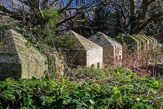
Image: © Mike Searle Taken: 18 Feb 2016
- Anti-tank Blocks: DoB ID: e24908 Poole - Tatnam Farm Allotments - Cubes. These anti-tank cubes in the allotments off Sherrin Close are a reminder that Poole was designated as an anti-tank island in 1940. There are over 30 "Dragon's Teeth" here, 6 have fallen, but around 20 are still upright, and they continue beyond into the grounds of St Mary's RC Church. These are the survivors of a continuous line that once extended from Poole Park to Creekmoor. The line went via Birds Hill Road and Garland Road, then north, before turning west along Sandbourne Road to join the anti-tank blocks here. The north of the town was an area that was considered particularly vulnerable, and accordingly where the defences were most concentrated. Image
Images are licensed for reuse under creativecommons.org/licenses/by-sa/2.0
Image Location
Latitude
50.728787
Longitude
-1.977987