
IMAGES TAKEN NEAR TO
Southcote Road, BOURNEMOUTH, BH1 3SW
Introduction
This page details the photographs taken nearby to Southcote Road, BH1 3SW by members of the Geograph project.
The Geograph project started in 2005 with the aim of publishing, organising and preserving representative images for every square kilometre of Great Britain, Ireland and the Isle of Man.

There are currently over 7.5m images from over14,400 individuals and you can help contribute to the project by visiting https://www.geograph.org.uk
Image Map
Images are licensed for reuse under creativecommons.org/licenses/by-sa/2.0
Notes
- Clicking on the map will re-center to the selected point.
- The higher the marker number, the further away the image location is from the centre of the postcode.
Image Listing (146 Images Found)
Images are licensed for reuse under creativecommons.org/licenses/by-sa/2.0
Image
Details
Distance
1
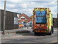
Bournemouth: Southcote Road Depot
A dustcart finishes this morning's collection and turns into the main Bournemouth Borough Council depot in Southcote Road. The main building, visible through the gateway, was originally the borough tramsheds.
Image: © Chris Downer
Taken: 19 Mar 2008
0.03 miles
2
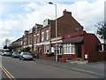
Bournemouth: Southcote Road
Looking along the eastern end of Southcote Road. Number 131, the second premises along in this picture, was Southcote Road Post Office until its closure on 3 March 1980.
Image: © Chris Downer
Taken: 19 Mar 2008
0.04 miles
3
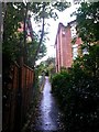
Bournemouth: footpath D03 heads uphill
This public footpath is a steepish alley leading down from Carlton Road, ahead, onto Spencer Road behind us. We see it here at roughly its mid-point - these two properties in Carlton Road have a hedge and fences, while the Spencer Road houses behind us have high walls.
See Image for the view down here from Carlton Road, and Image for the view behind us from here, with links to further photos on the path.
Image: © Chris Downer
Taken: 30 Sep 2016
0.05 miles
4
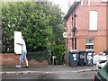
Bournemouth: the top of footpath D03
This public footpath is a steepish alley leading down from Carlton Road onto Spencer Road. We see it here at its top end as a man in a medical boot struggles somewhat carrying a large object.
See Image for the next view on the path ahead, with links to further photos on the route.
Image: © Chris Downer
Taken: 30 Sep 2016
0.05 miles
5
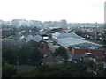
Old Trams Sheds and Bournemouth Business Park
Taken from St Clements Church Tower
Image: © Wilf Vernon
Taken: 13 Sep 2008
0.05 miles
6
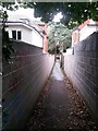
Bournemouth: footpath D03 heads downhill
This public footpath is a steepish alley leading down from Carlton Road behind us onto Spencer Road. We see it here at roughly its mid-point - these two properties in Spencer Road have breeze-block walls while behind us, the Carlton Road neighbours have fences and a hedge.
See Image for the next view on the path ahead, and Image for the next view behind us from here.
Image: © Chris Downer
Taken: 30 Sep 2016
0.08 miles
7
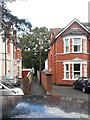
Bournemouth: footpath D03 from Spencer Road
This public footpath is a steepish alley leading up to Carlton Road. We see it here from across the roof of a parked car in Spencer Road - this is pretty much the nearest street to the town centre with free, unlimited on-street parking so it fills early morning with commuter cars.
See Image for the view out to the road from just up the path, and links to further pictures on the route.
Image: © Chris Downer
Taken: 30 Sep 2016
0.08 miles
8
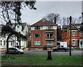
A wartime tragedy, and the death of baby Jane - 19, Spencer Road (4)
-
This is the property that occupies the site of 19, Spencer Road today. Along with no. 29 on the corner, it is clearly a post-war dwelling in a street that otherwise consists of late-Victorian properties. Both nos. 19, and 29, are therefore assumed to have been demolished and rebuilt after the war. James Mitchell aged 69, his wife Fanny aged 68, and Lily Mugg aged 47, all died here in the bombing on the night of 9th November 1940.
Image
Image: © Mike Searle
Taken: 12 Mar 2017
0.09 miles
9
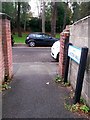
Bournemouth: Carlton Walk sign on footpath D03
This public footpath is a steepish alley leading down from Carlton Road behind us onto Spencer Road. We see it here as it reaches the bottom, and see alongside us a sign marked Carlton Walk. This is part of a fairly recent safety initiative in several parts of Bournemouth, whereby paths are named so that, in any emergency, one can give the name of the path rather than a description of the location which one might not know well.
See Image for the view up the path from ahead, and Image for the next view on the path behind us, with links to further pictures on the route.
Image: © Chris Downer
Taken: 30 Sep 2016
0.09 miles
10
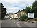
Southcote Road, Bournemouth
Southcote Road is a minor road in the suburbs of Bournemouth.
Image: © Malc McDonald
Taken: 17 Aug 2021
0.09 miles