
IMAGES TAKEN NEAR TO
Bury Road, POOLE, BH13 7DD
Introduction
This page details the photographs taken nearby to Bury Road, BH13 7DD by members of the Geograph project.
The Geograph project started in 2005 with the aim of publishing, organising and preserving representative images for every square kilometre of Great Britain, Ireland and the Isle of Man.

There are currently over 7.5m images from over14,400 individuals and you can help contribute to the project by visiting https://www.geograph.org.uk
Image Map
Images are licensed for reuse under creativecommons.org/licenses/by-sa/2.0
Notes
- Clicking on the map will re-center to the selected point.
- The higher the marker number, the further away the image location is from the centre of the postcode.
Image Listing (14 Images Found)
Images are licensed for reuse under creativecommons.org/licenses/by-sa/2.0
Image
Details
Distance
1
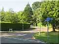
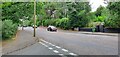
Bury Road, Branksome Park, near Poole
Bury Road in Branksome Park, a suburb of Poole.
The signs indicate that this is on the route of National Cycle Network route 25, linking Bournemouth with Longleat.
Image: © Malc McDonald
Taken: 25 Aug 2021
0.05 miles
2
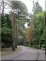
Branksome Park, Bury Road
A typical road in the centre of Branksome Park Conservation Area; mature pine trees, evergreen hedging, large house plots, with their houses often not visible from the road. http://boroughofpoole.com/downloads/assets/new_Branksome_Park_Conservation_Brochure.pdf
Image: © Mike Faherty
Taken: 23 Sep 2009
0.09 miles
3
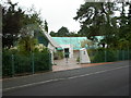
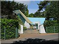
Branksome Park, Thunderbird
Spectacular prize-winning house on Western Avenue; semi-circular, with projecting wings. Bold use of metal, concrete and glass. http://www.sevendevs.com/website/home.html
Image: © Mike Faherty
Taken: 23 Sep 2009
0.10 miles
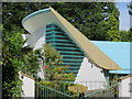
7
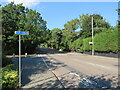
Canford Cliffs Road, near Poole
Canford Cliffs Road near Poole.
The blue sign indicates the route of National Cycle Network route 25 which heads to Poole, then onwards towards Longleat.
Image: © Malc McDonald
Taken: 25 Aug 2021
0.14 miles
8
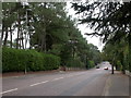
Branksome Park, Canford Cliff Road
Wide road from Branksome to Canford Cliffs. To the East (left in this picture) is the boundary of Branksome Park Conservation Area.
Image: © Mike Faherty
Taken: 23 Sep 2009
0.14 miles
9
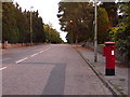
Canford Cliffs: postbox № BH14 303, Canford Cliffs Road
Canford Cliffs Road is actually entirely within BH13, of which postcode area it forms the western boundary. Through roads to the west, such as Lnks Road which comes out directly behind the camera, are in BH14 and I expect the box is emptied on a route from that direction.
The final collection times are 5:30pm on weekdays and noon on Saturdays.
Image: © Chris Downer
Taken: 5 Aug 2009
0.15 miles
10
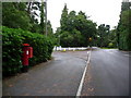
Branksome: postbox № BH13 153, Western Avenue
This George V-reign postbox serves mainly upmarket houses in large grounds. It is emptied finally at 5:30pm on weekdays and at 11:45am on Saturdays. Bury Road crosses Western Avenue at this slightly staggered crossroads.
Image: © Chris Downer
Taken: 3 Aug 2009
0.16 miles