
IMAGES TAKEN NEAR TO
Knighton Heath Road, BOURNEMOUTH, BH11 9PN
Introduction
This page details the photographs taken nearby to Knighton Heath Road, BH11 9PN by members of the Geograph project.
The Geograph project started in 2005 with the aim of publishing, organising and preserving representative images for every square kilometre of Great Britain, Ireland and the Isle of Man.

There are currently over 7.5m images from over14,400 individuals and you can help contribute to the project by visiting https://www.geograph.org.uk
Image Map
Images are licensed for reuse under creativecommons.org/licenses/by-sa/2.0
Notes
- Clicking on the map will re-center to the selected point.
- The higher the marker number, the further away the image location is from the centre of the postcode.
Image Listing (58 Images Found)
Images are licensed for reuse under creativecommons.org/licenses/by-sa/2.0
Image
Details
Distance
1
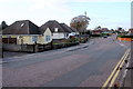
Bungalows on High Howe Lane
This area of suburban Bournemouth has many houses like these. These ones are close to the junction of High Howe Lane and Meadow View Rd and Knighton Heath Rd.
Image: © Nigel Mykura
Taken: 25 Nov 2018
0.05 miles
2
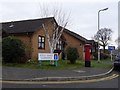
West Howe: postbox № BH11 207, High Oaks Gardens
High Oaks Gardens, a relatively recent development, has had this postbox since shortly after West Howe Post Office closed, just up the road, in March 2004 (see Image).
Image: © Chris Downer
Taken: 4 Jan 2009
0.06 miles
3
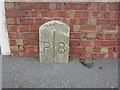
Old Boundary Marker by Hull Road, Bournemouth parish
Parish Boundary Marker by the UC road, in parish of Bournemouth (Bournemouth District), Hull Road (right hand side), in front of No. 2 boundary wall.
Opposite Boundary marker: DO_POBO02pb Image
Inscription reads:-
P|B
Surveyed
Milestone Society National ID: DO_POBO01pb
Image: © Milestone Society
Taken: Unknown
0.07 miles
4
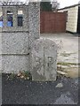
Old Boundary Marker by Hull Road, Bournemouth parish
Parish Boundary Marker by the UC road, in parish of Bournemouth (Bournemouth District), Hull Road (left hand side), in front of side access to No. 69 High Howe Lane, by wall and drive, South side of road.
Opposite Boundary Marker: DO_POBO01pb Image
Inscription reads:-
B|P
Surveyed
Milestone Society National ID: DO_POBO02pb
Image: © Milestone Society
Taken: Unknown
0.08 miles
5
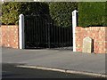
Bearwood: Bournemouth/Poole boundary stone
The Bearwood housing estate was built in the 1980s and had no regard for the borough boundary: in some cases the boundary goes right through houses, such as here in Hull Road.
The border is not accurately marked on the 1:50,000 map at this point; it does not coincide with High Howe Lane but is parallel to it a little back from the road.
Image: © Chris Downer
Taken: 7 Dec 2008
0.08 miles
6
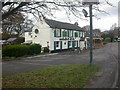
West Howe, Shoulder of Mutton
Built on what is a now a service road to the parallel Ringwood Road, the Shoulder of Mutton is one of Bournemouth's oldest pubs, dating from days when West Howe was farm, wood or heathland. Listed in the 2009 Good Beer Guide, the pub feels very much a local. Porch, with to left stone-flagged public bar, and to right T-shaped lounge with beamed ceiling. Cask ales on offer at my visit: Dorset Piddle Santa's Potty, Ringwood Fortyniner. For some customer reviews, see http://www.beerintheevening.com/pubs/comments.shtml/2889/
Image: © Mike Faherty
Taken: 8 Dec 2008
0.09 miles
7
Bearwood: postbox № BH11 209, Hull Road
This postbox is physically in Poole but postally in Bournemouth. We are actually looking at it across the border from Bournemouth: see Image
Image: © Chris Downer
Taken: 7 Dec 2008
0.09 miles
8
West Howe, topiary
Immaculate topiary in Hull Road.
Image: © Mike Faherty
Taken: 1 Feb 2009
0.09 miles
9
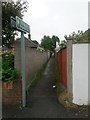
West Howe: footpath U09 to Ringwood Road
A public footpath 114 metres in length, perfectly straight but for the very minor double bend about two thirds of the way along - see Image
Image: © Chris Downer
Taken: 26 Jun 2016
0.10 miles
10
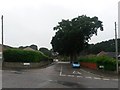
West Howe: High Howe Close from High Howe Lane
Looking on a drab rainy evening along High Howe Close from its northern end.
The first segment, from here till it turns into Littlemoor Avenue, is designated a byway open to all traffic. I don't know why this particular stretch of road should be labelled as such: maybe it was a historical route when this was heathland, and the modern road network incorporated it. It is numbered U12 on Bournemouth Borough Council's list of public rights of way.
See Image for a picture of the trees and bungalows a little way down.
Image: © Chris Downer
Taken: 26 Jun 2016
0.10 miles