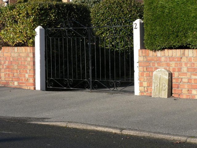
Bearwood: Bournemouth/Poole boundary stone
Introduction
The photograph on this page of Bearwood: Bournemouth/Poole boundary stone by Chris Downer as part of the Geograph project.
The Geograph project started in 2005 with the aim of publishing, organising and preserving representative images for every square kilometre of Great Britain, Ireland and the Isle of Man.
There are currently over 7.5m images from over 14,400 individuals and you can help contribute to the project by visiting https://www.geograph.org.uk

Image: © Chris Downer Taken: 7 Dec 2008
The Bearwood housing estate was built in the 1980s and had no regard for the borough boundary: in some cases the boundary goes right through houses, such as here in Hull Road. The border is not accurately marked on the 1:50,000 map at this point; it does not coincide with High Howe Lane but is parallel to it a little back from the road.

