
IMAGES TAKEN NEAR TO
Wimborne Road, BOURNEMOUTH, BH11 9AU
Introduction
This page details the photographs taken nearby to Wimborne Road, BH11 9AU by members of the Geograph project.
The Geograph project started in 2005 with the aim of publishing, organising and preserving representative images for every square kilometre of Great Britain, Ireland and the Isle of Man.

There are currently over 7.5m images from over14,400 individuals and you can help contribute to the project by visiting https://www.geograph.org.uk
Image Map
Images are licensed for reuse under creativecommons.org/licenses/by-sa/2.0
Notes
- Clicking on the map will re-center to the selected point.
- The higher the marker number, the further away the image location is from the centre of the postcode.
Image Listing (78 Images Found)
Images are licensed for reuse under creativecommons.org/licenses/by-sa/2.0
Image
Details
Distance
1

Wimborne Road, Bear Cross, near Bournemouth
A view along Wimborne Road in Bear Cross, in the northern outskirts of Bournemouth.
The road to the right of the trees is also Wimborne Road. That section is on the route of the A341 as it passes through Bear Cross.
Image: © Malc McDonald
Taken: 9 Feb 2025
0.03 miles
2
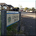
Bear Cross: Longfield Drive
A very short road linking the main Wimborne Road with Cudnell Avenue, which runs parallel with Wimborne Road and has a dead end at both ends. Immediately in front of us is a service road serving the odd numbers 1761 to 1823 Wimborne Road, comfortably the highest house numbers in the area.
Longfield Drive, meanwhile, almost need not be named, since it contains no addresses at all.
The road sign is a standard one from around 2000-2006, perhaps a little earlier, featuring the borough coat of arms.
This is photo no.246 of a series of 453 in my coronavirus lockdown walking project:
See https://www.geograph.org.uk/article/My-2020-Coronavirus-Lockdown-walking-project for the complete set of photos.
Image: © Chris Downer
Taken: 16 Apr 2020
0.03 miles
3
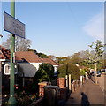
Bear Cross: Cudnell Avenue
Cudnell Avenue is quite unusual in having two dead ends - it backs onto the River Stour and is accessed via either Quayle Drive, not quite at the western dead end, or Longfield Drive, not quite at the eastern dead end.
Here, we look along it from the latter turning, and the turning circle at the eastern end can be seen in the background.
The road sign is a standard one from around 2000-2006, perhaps a little earlier, featuring the borough coat of arms, but is an unframed version set high on a lamp post rather than the usual position on two posts.
This is photo no.96 of a series of 453 in my coronavirus lockdown walking project:
See https://www.geograph.org.uk/article/My-2020-Coronavirus-Lockdown-walking-project for the complete set of photos.
Image: © Chris Downer
Taken: 16 Apr 2020
0.03 miles
4
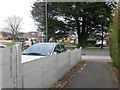
Kinson: footpath E21 arrives on Wimborne Road
This public footpath has come originally from Baker Road, passed the dead end of Anstey Close, and now comes out at its destination, the main A341 Wimborne Road.
See Image for the view along the path from across the road, and Image for the next view on the path behind us, with links to further photos along the path.
Image: © Chris Downer
Taken: 18 Mar 2017
0.03 miles
5
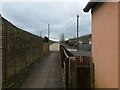
Kinson: footpath E22 emerges onto Cudnell Avenue
This short public footpath provides access from Cudnell Avenue onto the Millhams Mead local nature reserve. We see it here in the opposite direction, as it arrives at the dead end of Cudnell Avenue.
See Image for the view down the path from the road ahead, and Image for the emergence onto Millhams Mead behind us.
Image: © Chris Downer
Taken: 18 Mar 2017
0.03 miles
6
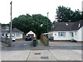
Kinson: footpath E22 from Cudnell Avenue
Unusually, numbering in Cudnell Avenue starts at a dead end - that's because both ends are dead ends. The pictured bungalows are clearly afterthoughts as they are numbered 1a (right) and 2a (left, with 2b and 2c next to them). Numbers 1 and 2 are to our direct right and left, out of picture.
A short public footpath runs between the odds and evens, straight ahead, into Millhams Mead (Image]).
See Image for the view towards us from a little way along the path, and Image for a view out of the end of the path into the wooded area beyond.
Image: © Chris Downer
Taken: 30 Jun 2016
0.03 miles
7
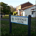
Bear Cross: Garsdale Close
This cul-de-sac off the main Wimborne Road curves immediately around to the right and has a couple of rows of houses facing each other across a footpath coming back out on the main road a bit further down.
It also provides access, by the big tree in the background, into Millhams Mead Local Nature Reserve (see Image).
The road sign is a standard one from around 2000-2006, perhaps a little earlier, featuring the borough coat of arms.
This is photo no.156 of a series of 453 in my coronavirus lockdown walking project:
See https://www.geograph.org.uk/article/My-2020-Coronavirus-Lockdown-walking-project for the complete set of photos.
Image: © Chris Downer
Taken: 16 Apr 2020
0.04 miles
8

Kinson: footpath E21 to Baker Road
Between 1697 and 1699 Wimborne Road runs a public footpath to Baker Road via Anstey Close.
See Image for the view towards us from a little way along the path, with links to further photos along the route.
Image: © Chris Downer
Taken: 30 Jun 2016
0.04 miles
9
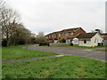
Garsdale Close, Kinson, near Bournemouth
Garsdale Close is a residential cul-de-sac in Kinson, in the northern outskirts of Bournemouth.
Image: © Malc McDonald
Taken: 9 Feb 2025
0.04 miles
10
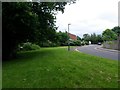
Kinson: Garsdale Close and Millhams Mead
Garsdale Close is a small cul-de-sac off the main Wimborne Road and alongside it is an entrance to Millhams Mead local nature reserve, a narrow wood and grassland area abutting a minor course of the River Stour.
Image: © Chris Downer
Taken: 30 Jun 2016
0.04 miles