IMAGES TAKEN NEAR TO
Wimborne Road, BOURNEMOUTH, BH11 9AF

Introduction

This page details the photographs taken nearby to Wimborne Road, BH11 9AF by members of the Geograph project.

The Geograph project started in 2005 with the aim of publishing, organising and preserving representative images for every square kilometre of Great Britain, Ireland and the Isle of Man.

There are currently over 7.5m images from over14,400 individuals and you can help contribute to the project by visiting https://www.geograph.org.uk

Image Map


Images are licensed for reuse under creativecommons.org/licenses/by-sa/2.0
Notes
  • Clicking on the map will re-center to the selected point.
  • The higher the marker number, the further away the image location is from the centre of the postcode.

Image Listing (122 Images Found)

Images are licensed for reuse under creativecommons.org/licenses/by-sa/2.0
  • ...
Image
Details
Distance
1
Furniture Store
This shop is on the north side of the Wimborne Rd the A341 at Kinson. It is on the junction with Truman Rd.
Image: © Nigel Mykura Taken: 15 Nov 2011
0.02 miles
2
Dance Academy on Wimborne Road
Image: © JThomas Taken: 24 Mar 2022
0.02 miles
3
Kinson: postbox № BH11 373, Wimborne Road
This postbox stands outside Image
Image: © Chris Downer Taken: 21 Jul 2008
0.02 miles
4
Elizabeth II postbox on Wimborne Road
Postbox No. BH11 373.
Image: © JThomas Taken: 24 Mar 2022
0.02 miles
5
Kinson: post office
The post office is at the western end of the main shopping area of Kinson, at 1518 Wimborne Road.
Image: © Chris Downer Taken: 21 Jul 2008
0.02 miles
6
House on Wimborne Rd
This red brick Victorian detached house with a small modern extension sits at the junction with Truman Rd. The road in the foreground is the A341 Wimborne Rd.
Image: © Nigel Mykura Taken: 15 Nov 2011
0.03 miles
7
Wimborne Road (A341)
Image: © JThomas Taken: 24 Mar 2022
0.05 miles
8
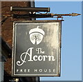
Sign for the Acorn public house
Image: © JThomas Taken: 24 Mar 2022
0.09 miles
9
Kinson: southern end of footpath E25
Roosevelt Crescent is a rather elongated crescent shape, turning back on itself quite sharply and with one end just along Truman Road from the other. The houses on the inside of the 180° turn do not follow the route of the road, but leave a semi-circular grass space between them and it (see Image). The path along their frontages is designated as public footpath E25 and it is a modest 42m in length, but by no means short in comparison to some other public footpaths in the borough. See Image for the view along the path from the other end, a view less obscured by parked cars.
Image: © Chris Downer Taken: 18 Mar 2017
0.09 miles
10
The Acorn public house
Image: © JThomas Taken: 24 Mar 2022
0.09 miles
  • ...