
IMAGES TAKEN NEAR TO
Frost Gardens, BOURNEMOUTH, BH11 8FD
Introduction
This page details the photographs taken nearby to Frost Gardens, BH11 8FD by members of the Geograph project.
The Geograph project started in 2005 with the aim of publishing, organising and preserving representative images for every square kilometre of Great Britain, Ireland and the Isle of Man.

There are currently over 7.5m images from over14,400 individuals and you can help contribute to the project by visiting https://www.geograph.org.uk
Image Map
Images are licensed for reuse under creativecommons.org/licenses/by-sa/2.0
Notes
- Clicking on the map will re-center to the selected point.
- The higher the marker number, the further away the image location is from the centre of the postcode.
Image Listing (55 Images Found)
Images are licensed for reuse under creativecommons.org/licenses/by-sa/2.0
Image
Details
Distance
1
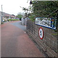
West Howe: Frost Gardens
A small infill development of little bungalows dating from 2016ish, on what was previously one of those council-estate back driveways to garages of several properties. There is pedestrian access onto Poole Lane at the far end.
The council's signage at this time had recently ditched the coloured logo, which had been prone to fading after a while, to simple wording BOURNEMOUTH BOROUGH COUNCIL in smaller type above the street name.
This is photo no.151 of a series of 453 in my coronavirus lockdown walking project:
See https://www.geograph.org.uk/article/My-2020-Coronavirus-Lockdown-walking-project for the complete set of photos.
Image: © Chris Downer
Taken: 18 Apr 2020
0.01 miles
2
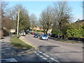
Bournemouth : Poole Lane
Looking towards a lollipop lady as soon all the children will be leaving school and going home.
Image: © Lewis Clarke
Taken: 8 Mar 2010
0.05 miles
3
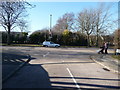
Bournemouth : Jephcote Road & Poole Lane
Approaching the road junction on Jephcote Road which runs from Poole Lane to Frost Road.
Image: © Lewis Clarke
Taken: 8 Mar 2010
0.05 miles
4
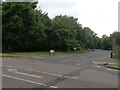
West Howe: Oakmead Gardens from Poole Lane
This is a small, modern housing development on a previously vacant plot. The left-hand edge of the plot had a public right of way, footpath U10, running along it, leading to Ringwood Road (see Image]). But with the development of Oakmead Gardens, a paved, shared foot/cycle path was installed too. The course of the public footpath on modern right of way maps is now the left-hand pavement of Oakmead Gardens, pictured, plus the meandering shared path.
See Image for the next view along Oakmead Gardens and links to further pictures along the right of way.
Image: © Chris Downer
Taken: 17 Jul 2016
0.05 miles
5
West Howe: the original start of footpath U10
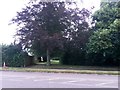
Looking across Poole Lane across the former course of a public footpath to Ringwood Road. It is still eminently navigable - however, a housing development, Oakmead Gardens, has been built in the last few years, part of which incorporates a tarmacked, shared foot/cycle path. As a result, modern right of way maps show the route of the footpath as having been diverted to follow the new surfaced route - along the pavement of Oakmead Gardens to start with, and then along the shared path.
See Image for the start of Oakmead Gardens, which is a short distance to our right, and links to further photos along the route.
Image: © Chris Downer
Taken: 17 Jul 2016
0.06 miles
6
Bournemouth : Frost Road
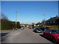
Frost Road taken from the road junction with to Jephcote Road.
Image: © Lewis Clarke
Taken: 8 Mar 2010
0.06 miles
7
Bournemouth : Oakmead Gardens
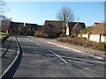
Oakmead Gardens doesn't go to any other road, but just is a close for more houses.
Image: © Lewis Clarke
Taken: 8 Mar 2010
0.06 miles
8

Turf Zone "WestHowe"
On Duck Lane, West Howe.
Image: © Ian S
Taken: 15 Nov 2022
0.07 miles
9
West Howe: Frost Road
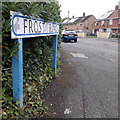
A curving road of semi-detached and terraced council housing at the fringe of the large 1950s West Howe council estate. In recent years, the council has invested in photovoltaic arrays on the roofs of those still under its ownership.
The road sign is a one-line version of the blue design which became prevalent in Bournemouth around 1990 and was in use for most of that decade. These narrower signs are much less common, even for road names that fit nicely on one line! (See Image for one neatly arranged on two lines, and Image for one written on one line but on a larger sign.)
This is photo no.152 of a series of 453 in my coronavirus lockdown walking project:
See https://www.geograph.org.uk/article/My-2020-Coronavirus-Lockdown-walking-project for the complete set of photos.
Image: © Chris Downer
Taken: 18 Apr 2020
0.08 miles
10
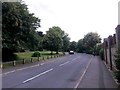
West Howe: small playing field alongside Oakmead Gardens
Looking along this modern housing estate road, whose southern pavement now forms part of public footpath U10 towards Ringwood Road.
The original course of the public right of way was a dead-straight run abutting a fence the far side of the playing field (still walkable today; see Image), but with the recent development being built, a paved, shared foot/cycle path has been installed and the public right of way is shown as that meandering route on recent right of way maps, followed by this left-hand pavement of Oakmead Gardens.
Two lads can just be seen playing football far left; the metal goalpost might just be discerned, too.
See Image for the next view on the path ahead, with links to further photos along the route of the public footpath, and Image for view along Oakmead Gardens from the end behind us.
Image: © Chris Downer
Taken: 17 Jul 2016
0.08 miles