
IMAGES TAKEN NEAR TO
New Road, BOURNEMOUTH, BH10 7DP
Introduction
This page details the photographs taken nearby to New Road, BH10 7DP by members of the Geograph project.
The Geograph project started in 2005 with the aim of publishing, organising and preserving representative images for every square kilometre of Great Britain, Ireland and the Isle of Man.

There are currently over 7.5m images from over14,400 individuals and you can help contribute to the project by visiting https://www.geograph.org.uk
Image Map
Images are licensed for reuse under creativecommons.org/licenses/by-sa/2.0
Notes
- Clicking on the map will re-center to the selected point.
- The higher the marker number, the further away the image location is from the centre of the postcode.
Image Listing (43 Images Found)
Images are licensed for reuse under creativecommons.org/licenses/by-sa/2.0
Image
Details
Distance
1
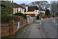
Houses on the bend just before Ensbury Bridge
Image: © David Martin
Taken: 2 Feb 2020
0.03 miles
2
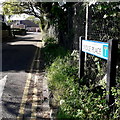
Northbourne: Bridge Place
A small cul-de-sac off the main A347 New Road, with housing only on one side and at the end because it directly abuts the River Stour, just to our right.
The sign is a modern one, erected around 2018, by which time the council had replaced the coloured logo, which had been prone to fading after a while, to simple wording BOURNEMOUTH BOROUGH COUNCIL in smaller type.
This is photo no.48 of a series of 453 in my coronavirus lockdown walking project:
See https://www.geograph.org.uk/article/My-2020-Coronavirus-Lockdown-walking-project for the complete set of photos.
Image: © Chris Downer
Taken: 15 Apr 2020
0.06 miles
3
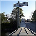
Northbourne: New Road
One of the most important routes into Bournemouth, New Road is the A347 from Ferndown. It is not 'new' but it was when it was built (which I suppose is true of all roads!).
We see it here as it crosses Ensbury Bridge, over the River Stour, and therefore over the historic boundary into the Borough of Bournemouth, as it was until April 2019 when Bournemouth, Poole and Christchurch local authorities merged.
The sign is of a design that became prevalent in Bournemouth around 1990 and was in use for most of that decade, with blue border and, when mounted on the pavement, on blue legs. The addition here of the word Bournemouth and the borough coat of arms is of course because this is the entry point to the borough. The centre point of the river is the boundary, so the positioning of the sign is very exact!
This is photo no.248 of a series of 453 in my coronavirus lockdown walking project:
See https://www.geograph.org.uk/article/My-2020-Coronavirus-Lockdown-walking-project for the complete set of photos.
Image: © Chris Downer
Taken: 15 Apr 2020
0.06 miles
5
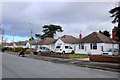
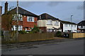
Bungalows on Markham Avenue
These suburban bungalows are on a quiet residential cul-de-sac on the very northern edge of the Bournemouth conurbation.
Image: © Nigel Mykura
Taken: 7 Feb 2019
0.07 miles
6
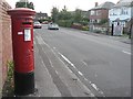
Northbourne: postbox № BH10 283, Kinson Park Road
Looking west along Kinson Park Road past this George V-reign postbox.
Image: © Chris Downer
Taken: 21 Jul 2008
0.07 miles
7
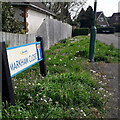
Kinson: Markham Close
In a town that has seen much infill development in the last 20 years, Markham Close is a fairly historic offshoot, dating from maybe the mid 1970s. It comes off Markham Avenue, itself a no through road.
The sign is a modern one, from 2010-15 when this more modern, abstract emblem rather than the traditional town coat of arms as the working logo of the council. The no-through-road sign incorporated into the sign is a common arrangement.
This is photo no.262 of a series of 453 in my coronavirus lockdown walking project:
See https://www.geograph.org.uk/article/My-2020-Coronavirus-Lockdown-walking-project for the complete set of photos.
Image: © Chris Downer
Taken: 12 Apr 2020
0.07 miles
8
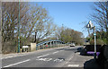
Ensbury Bridge
Ensbury Bridge carries the A347 New Road across the River Stour.
Image: © Peter Kazmierczak
Taken: 28 Mar 2012
0.08 miles
9
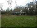
Parley, Ensbury Bridge
Built 1910, two-span girder bridge with central concrete piers. As seen from the Eastern (East Dorset) side, near the river bank; the other side is in Bournemouth. For a view at road level, see Image
Image: © Mike Faherty
Taken: 28 Feb 2009
0.08 miles
10
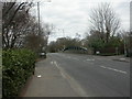
Bournemouth, Ensbury Bridge
Built 1910; carrying New Road over the River Stour; also forming the boundary between Bournemouth & East Dorset. For information on the A347, see http://www.sabre-roads.org.uk/wiki/index.php?title=A347 As seen from the Bournemouth side; for a view from below, see Image
Image: © Mike Faherty
Taken: 28 Feb 2009
0.08 miles