
IMAGES TAKEN NEAR TO
Headswell Avenue, BOURNEMOUTH, BH10 6LB
Introduction
This page details the photographs taken nearby to Headswell Avenue, BH10 6LB by members of the Geograph project.
The Geograph project started in 2005 with the aim of publishing, organising and preserving representative images for every square kilometre of Great Britain, Ireland and the Isle of Man.

There are currently over 7.5m images from over14,400 individuals and you can help contribute to the project by visiting https://www.geograph.org.uk
Image Map
Images are licensed for reuse under creativecommons.org/licenses/by-sa/2.0
Notes
- Clicking on the map will re-center to the selected point.
- The higher the marker number, the further away the image location is from the centre of the postcode.
Image Listing (105 Images Found)
Images are licensed for reuse under creativecommons.org/licenses/by-sa/2.0
Image
Details
Distance
1
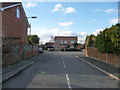
Bournemouth : Justin Gardens
A little cul-de-sac named after Justin - whoever he may be.
Image: © Lewis Clarke
Taken: 11 Feb 2010
0.02 miles
2

Bournemouth : Headswell Avenue
A slight downhill slope on the road, and a junction into Justin Gardens on the left.
Image: © Lewis Clarke
Taken: 11 Feb 2010
0.02 miles
3
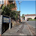
Northbourne: Justin Gardens
A small cul-de-sac off Headswell Avenue, in a small stretch of the latter which has more modern (perhaps 70s) housing compared with the remainder which dates from the 1930s.
The sign is a modern one, from 2010-15 when this more modern, abstract emblem rather than the traditional town coat of arms as the working logo of the council. The no-through-road sign incorporated into the nameplate is a common arrangement.
This is photo no.217 of a series of 453 in my coronavirus lockdown walking project:
See https://www.geograph.org.uk/article/My-2020-Coronavirus-Lockdown-walking-project for the complete set of photos.
Image: © Chris Downer
Taken: 2 May 2020
0.04 miles
4
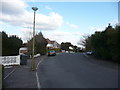
Bournemouth : Headswell Avenue
The avenue turns a corner. There is also a street light in view.
Image: © Lewis Clarke
Taken: 11 Feb 2010
0.05 miles
5
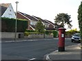
Northbourne: postbox № BH10 291, Headswell Avenue
A George V-reign postbox on the corner of Headswell Avenue and Crescent.
Image: © Chris Downer
Taken: 30 Jun 2008
0.05 miles
6
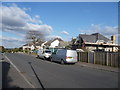
Bournemouth : Headswell Avenue
The scaffolding is up on one of the houses and some maintenance work is being carried out.
Image: © Lewis Clarke
Taken: 11 Feb 2010
0.06 miles
7
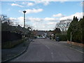
Bournemouth : Headswell Gardens
First there was an avenue, then there was a crescent, now we have some Headswell Gardens.
There is a plane in the sky as well, probably landing at the nearby airport.
Image: © Lewis Clarke
Taken: 11 Feb 2010
0.07 miles
8
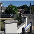
Northbourne: Headswell Crescent
Headswell Crescent forms a standard crescent shape off the eastern side of Headswell Avenue, but at this southern end also crosses it to meet Saxonhurst Road, the next road behind us. It is typical Northbourne - decent, desirable detached housing and a mix of houses and bungalows.
The sign is a modern one - it is only in the last couple of years that Bournemouth Borough Council stopped including its name in smaller type at the top of the sign, perhaps in readiness for local government reorganisation in April 2019 which saw the borough council replaced by BCP (Bournemouth, Christchurch & Poole) council.
This is photo no.186 of a series of 453 in my coronavirus lockdown walking project:
See https://www.geograph.org.uk/article/My-2020-Coronavirus-Lockdown-walking-project for the complete set of photos.
Image: © Chris Downer
Taken: 10 Apr 2020
0.07 miles
9
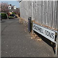
Northbourne: Headswell Gardens
The position of the nameplate, halfway along the triangular widening of the pavement at the junction, allows us only a glimpse of one of the bungalows in this short cul-de-sac. It is a typically desirable dwelling of this whole Northbourne area.
The sign is the standard Bournemouth nameplate from the 1980s, affixed with tubular steel which protrudes at each side. It was a common arrangement at the time the sign was installed, to have alongside a full-size no-through-road sign on a very short post.
This is photo no.187 of a series of 453 in my coronavirus lockdown walking project:
See https://www.geograph.org.uk/article/My-2020-Coronavirus-Lockdown-walking-project for the complete set of photos.
Image: © Chris Downer
Taken: 10 Apr 2020
0.07 miles
10
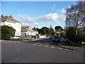
Bournemouth : Headswell Crescent
Headswell Crescent on the junction with Headswell Avenue.
Image: © Lewis Clarke
Taken: 11 Feb 2010
0.07 miles