
IMAGES TAKEN NEAR TO
Redhill Drive, BOURNEMOUTH, BH10 6AD
Introduction
This page details the photographs taken nearby to Redhill Drive, BH10 6AD by members of the Geograph project.
The Geograph project started in 2005 with the aim of publishing, organising and preserving representative images for every square kilometre of Great Britain, Ireland and the Isle of Man.

There are currently over 7.5m images from over14,400 individuals and you can help contribute to the project by visiting https://www.geograph.org.uk
Image Map
Images are licensed for reuse under creativecommons.org/licenses/by-sa/2.0
Notes
- Clicking on the map will re-center to the selected point.
- The higher the marker number, the further away the image location is from the centre of the postcode.
Image Listing (113 Images Found)
Images are licensed for reuse under creativecommons.org/licenses/by-sa/2.0
Image
Details
Distance
3
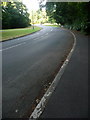
Redhill: black and white kerb in Wimborne Road
This section of Wimborne Road was formerly the main route north out of Bournemouth, until the Whitelegg Way, seen crossing in the distance, was built in the late 1980s.
Since the arrival of the Whitelegg Way, this stretch of road survives only as a bus route and as access to the side-roads. The alternating black and white painted kerbstones, which would have been important markers for this sharp bend when the road carried more traffic, are deteriorating but still discernible 25 years after they last served any useful purpose.
Image: © Chris Downer
Taken: 26 Jul 2013
0.05 miles

5
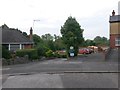
Redhill: B.O.A.T. O18 from Wimborne Road
The left-hand of these two driveways is a public right of way, a byway open to all traffic (or B.O.A.T.) which today appears to be a private drive to Redhill Park Homes. The right of way does not seem to have any apparent function as a through route - however, a look at the historical map shows us that it comes to an end at the original main course of the river (with a ford marked on the map). The original course of the river is still evident on the modern-day map because the borough boundary follows that course.
See Image for a view a little way along the drive, plus further links.
Image: © Chris Downer
Taken: 6 Jul 2016
0.06 miles

7
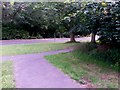
Redhill: bridleway O14 joins Wimborne Road
This paved bridleway, from the subway under Whitelegg Way, approaches the pavement of Wimborne Road, which is separated from the carriageway by a wide grassed area.
However, this isn't quite the end of the official bridleway: see Image for a further view ahead.
See also Image for the next view of the bridleway behind us, with links to further pictures along the routes mentioned.
Image: © Chris Downer
Taken: 6 Jul 2016
0.07 miles
8
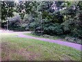
Redhill: bridleways O14 and O16 meet
Looking along this paved bridleway, O14, as it comes off Wimborne Road towards the subway behind us.
Meanwhile, another public bridleway, O16, far more rural feeling but very short, comes out through a gap in the trees.
See:
Image for the continuation of the paved route ahead;
Image for the approach to the subway behind us; and
Image for a view along the route through the trees from just ahead-left.
Each link provides further links to other photos along the route.
Image: © Chris Downer
Taken: 6 Jul 2016
0.07 miles
9

Redhill: bridleway O14 comes out of the subway
The next view along this short public bridleway from Image as it emerges on the south side. See Image for the view towards us.
Image: © Chris Downer
Taken: 6 Jul 2016
0.07 miles
10
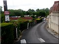
Redhill: Redhill Park Homes
The driveway here leads to Redhill Park Homes, over which we have a good view thanks to a steepish gradient. The driveway is mapped a public right of way, a byway open to all traffic (or B.O.A.T.) number O18, which today appears to be just a private drive to the Homes. The right of way does not seem to have any apparent function as a through route - however, a look at the historical map shows us that it comes to an end at the original main course of the river (with a ford marked on the map). The original course of the river is still evident on the modern-day map because the borough boundary follows that course.
See Image for a view from the top of the drive behind us, and Image for a further view ahead.
Image: © Chris Downer
Taken: 6 Jul 2016
0.07 miles