1
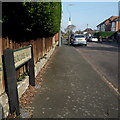
Kinson: Burcombe Road
Burcombe Road forms the south side of a sort of self-contained square of roads, the main Kinson Road forming the western side. Like its compatriots Hyde Road on the north and east sides and Middle Road (which runs through the middle as its name suggests), they start off with detached houses at this western end and then bungalows take over.
The sign is a modern one, probably from around 2000, and is not rare in this neck of the woods. It morphed into another design, in blue rather than green and far more widely seen, including BOURNEMOUTH BOROUGH COUNCIL in smaller letters at the top, and the borough coat of arms on the left.
This is photo no.57 of a series of 453 in my coronavirus lockdown walking project:
See https://www.geograph.org.uk/article/My-2020-Coronavirus-Lockdown-walking-project for the complete set of photos.
Image: © Chris Downer
Taken: 12 Apr 2020
0.01 miles
2
Kinson: postbox № BH10 294, Kinson Road
Looking across the turning of Burcombe Road, a short distance south of the centre of the Bournemouth suburb of Kinson.
Image: © Chris Downer
Taken: 21 Jul 2008
0.02 miles
3
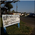
Kinson: Glenmeadows Drive
Glenmeadows Drive is a cul-de-sac of houses from probably the 1970s, off Kinson Road. Griffiths Gardens, referred to on the sign, is more modern.
The sign is of a design that became prevalent in Bournemouth around 1990 and was in use for most of that decade. Many are starting to look a bit shabby now: the blue border is often the first to go, but that is in reasonably good nick on this one, although the same cannot be said for the white surface.
The additional message below the street name was always written in the smaller, sanserif type.
This is photo no.163 of a series of 453 in my coronavirus lockdown walking project:
See https://www.geograph.org.uk/article/My-2020-Coronavirus-Lockdown-walking-project for the complete set of photos.
Image: © Chris Downer
Taken: 11 Apr 2020
0.05 miles
4
Kinson: Middle Road
Middle Road is part of an estate of bungalows, the roads forming the shape of a three-pronged fork without the handle. As its name suggests, Middle Road is the middle 'prong'.
The sign is a modern one, dating from around 2014-15, by which time the council had replaced the coloured logo, which had been prone to fading after a while, to simple wording BOURNEMOUTH BOROUGH COUNCIL in smaller type.
This is photo no.269 of a series of 453 in my coronavirus lockdown walking project:
See https://www.geograph.org.uk/article/My-2020-Coronavirus-Lockdown-walking-project for the complete set of photos.
Image: © Chris Downer
Taken: 12 Apr 2020
0.05 miles
5
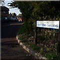
Kinson: Griffiths Gardens
A fairly modern cul-de-sac (perhaps early 1990s) of houses off Glenmeadows Drive, which is itself a no-through road off Kinson Road. It backs on to Kinson Common and there is public access just by the turning here, to our right.
The sign is a modern one, from 2010-15 when this more modern, abstract emblem rather than the traditional town coat of arms as the working logo of the council.
This is photo no.176 of a series of 453 in my coronavirus lockdown walking project:
See https://www.geograph.org.uk/article/My-2020-Coronavirus-Lockdown-walking-project for the complete set of photos.
Image: © Chris Downer
Taken: 11 Apr 2020
0.07 miles
6
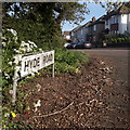
Kinson: Hyde Road
Seen here from Kinson Road, Hyde Road forms the northern and eastern sides of a self-contained square, Burcombe Road forming the south side and, of course, Kinson Road the west. Middle Road crosses the square but there are no other roads meeting it from outside the square.
Hyde Road has a little kink in it, rather inexplicably, with a 90º left and 90º right in quick succession.
The sign is the standard Bournemouth nameplate from the 1980s, affixed with tubular steel which protrudes at each side.
This is photo no.211 of a series of 453 in my coronavirus lockdown walking project:
See https://www.geograph.org.uk/article/My-2020-Coronavirus-Lockdown-walking-project for the complete set of photos.
Image: © Chris Downer
Taken: 12 Apr 2020
0.08 miles
7
Kinson: Duke?s Coppice from Hyde Road
Looking along the north-south facing segment of Hyde Road (it turns 90° left at the bottom), with the trees of Duke's Coppice in the distance.
It is quarter past four on a fine November afternoon, so it is perhaps an hour or so since the road and bungalows last saw the sun - but the tops of the trees have a little more sunlight left and contrast nicely with the darker foreground.
A footpath leads into the Coppice from the bottom corner of the road - see
Image for a view and links to further photos.
Image: © Chris Downer
Taken: 6 Nov 2016
0.11 miles
8
Kinson: eastern arm of Hyde Road
Looking along the north-south facing segment of Hyde Road (it turns 90° left at the bottom), with the trees of Duke's Coppice in the distance.
It is quarter past four on a fine November afternoon, so it is perhaps an hour or so since the road and bungalows last saw the sun - but the tops of the trees have a little more sunlight left and contrast nicely with the darker foreground.
A footpath leads into the Coppice from the bottom corner of the road - see
Image for a view and links to further photos.
Image: © Chris Downer
Taken: 6 Nov 2016
0.11 miles
9
Kinson: toppled trees on the common
In the wooded part of Kinson Common, this is one of two neighbouring trees occupying the horizontal position.
Image: © Chris Downer
Taken: 17 Aug 2008
0.11 miles
10
Kinson: unusual tree
This tree is fallen, the bottom of its trunk not visible as it is behind the dense leaves. However, it appears to have fused with the stump of another tree in front of it.
Image: © Chris Downer
Taken: 17 Aug 2008
0.12 miles


