Kinson: Glenmeadows Drive
Introduction
The photograph on this page of Kinson: Glenmeadows Drive by Chris Downer as part of the Geograph project.
The Geograph project started in 2005 with the aim of publishing, organising and preserving representative images for every square kilometre of Great Britain, Ireland and the Isle of Man.

There are currently over 7.5m images from over 14,400 individuals and you can help contribute to the project by visiting https://www.geograph.org.uk
Kinson: Glenmeadows Drive
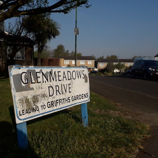
Image: © Chris Downer Taken: 11 Apr 2020
Glenmeadows Drive is a cul-de-sac of houses from probably the 1970s, off Kinson Road. Griffiths Gardens, referred to on the sign, is more modern. The sign is of a design that became prevalent in Bournemouth around 1990 and was in use for most of that decade. Many are starting to look a bit shabby now: the blue border is often the first to go, but that is in reasonably good nick on this one, although the same cannot be said for the white surface. The additional message below the street name was always written in the smaller, sanserif type. This is photo no.163 of a series of 453 in my coronavirus lockdown walking project: See https://www.geograph.org.uk/article/My-2020-Coronavirus-Lockdown-walking-project for the complete set of photos.
Images are licensed for reuse under creativecommons.org/licenses/by-sa/2.0
Image Location
Latitude
50.764809
Longitude
-1.90282