
IMAGES TAKEN NEAR TO
Old Mulberry Close, Kinson Road, BOURNEMOUTH, BH10 4JD
Introduction
This page details the photographs taken nearby to Old Mulberry Close, Kinson Road, BH10 4JD by members of the Geograph project.
The Geograph project started in 2005 with the aim of publishing, organising and preserving representative images for every square kilometre of Great Britain, Ireland and the Isle of Man.

There are currently over 7.5m images from over14,400 individuals and you can help contribute to the project by visiting https://www.geograph.org.uk
Image Map
Images are licensed for reuse under creativecommons.org/licenses/by-sa/2.0
Notes
- Clicking on the map will re-center to the selected point.
- The higher the marker number, the further away the image location is from the centre of the postcode.
Image Listing (75 Images Found)
Images are licensed for reuse under creativecommons.org/licenses/by-sa/2.0
Image
Details
Distance
1
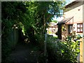
Wallisdown: midway along footpath N02
Travelling northbound along this public footpath, we reach the houses at the back of Talbot Mews, a recent development which abuts the course of the path ahead.
See Image for more on that, and Image for the next view behind us.
Image: © Chris Downer
Taken: 3 Jul 2016
0.01 miles
2
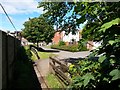
Wallisdown: footpath N02 abuts Talbot Mews
The modern development Talbot Mews almost but not quite encroaches on the route of footpath N02 from Wallisdown Road. We can see ahead that the original course of the footpath is still available, but is probably little used because it's easier to use the roadway.
See Image for a view along the path (and the Mews) from the end ahead, and Image] for the next view along the path behind us.
Image: © Chris Downer
Taken: 3 Jul 2016
0.02 miles
3
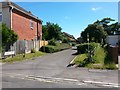
Wallisdown: footpath N02 and Talbot Mews from Alton Road
The modern development Talbot Mews almost but not quite encroaches on the route of footpath N02 to Wallisdown Road. We can see ahead that the original course of the footpath is still available, but is probably little used because there is an opening from the roadway a few yards ahead - see Image
Image: © Chris Downer
Taken: 3 Jul 2016
0.03 miles
4
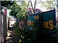
Wallisdown: King?s Arms sign on footpath N02
Looking along this public footpath as it arrives on Wallisdown Road at the corner of the pub grounds. I am not sure whether the sign is positioned deliberately as an advert facing the path, or if it has just been discarded there.
See Image for the view towards us, and Image for the next view along the path behind us.
Image: © Chris Downer
Taken: 3 Jul 2016
0.03 miles
5
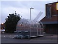
Wallisdown: damaged trolley park
In the rear car park of the Aldi supermarket, this trolley park has a damaged panel which was being buffeted by the high winds this evening. By the following day the panel had been removed.
Image: © Chris Downer
Taken: 18 Aug 2008
0.04 miles
6
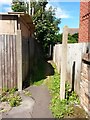
Wallisdown: the opening of footpath N02 by the King?s Arms
Detail of the entrance of the public footpath mentioned here: Image
See Image for the next view along the path.
Image: © Chris Downer
Taken: 3 Jul 2016
0.04 miles
7
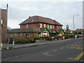
Wallisdown, The Kings Arms
Originally built in 1872; rebuilt for Eldridge Pope in 1923; more modern front extension. Cask ale on offer: Marston's Pedigree. For some customer reviews, see http://www.beerintheevening.com/pubs/s/26/2693/Kings_Arms/Wallisdown
Image: © Mike Faherty
Taken: 15 Jan 2009
0.04 miles
8
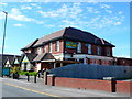
Kings Arms Wallisdown
The Kings Arms is a substantial red brick Eldridge Pope public house standing on the north side of Wallisdown Rd the A3049, not far from the junction with Kinson Rd.
Image: © Nigel Mykura
Taken: 8 May 2012
0.04 miles
9
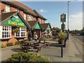
The Kings Arms
Wallisdown Road, Wallisdown.
For more info see Image
Image: © David Lally
Taken: 18 Oct 2009
0.05 miles
10
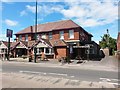
Wallisdown: the King?s Arms and footpath N02
A public footpath from Alton Road comes out at the edge of the King's Arms frontage, by the concrete post far right of picture.
See Image for the next view along the path.
Image: © Chris Downer
Taken: 3 Jul 2016
0.05 miles