
IMAGES TAKEN NEAR TO
Ashburton Gardens, BOURNEMOUTH, BH10 4HP
Introduction
This page details the photographs taken nearby to Ashburton Gardens, BH10 4HP by members of the Geograph project.
The Geograph project started in 2005 with the aim of publishing, organising and preserving representative images for every square kilometre of Great Britain, Ireland and the Isle of Man.

There are currently over 7.5m images from over14,400 individuals and you can help contribute to the project by visiting https://www.geograph.org.uk
Image Map
Images are licensed for reuse under creativecommons.org/licenses/by-sa/2.0
Notes
- Clicking on the map will re-center to the selected point.
- The higher the marker number, the further away the image location is from the centre of the postcode.
Image Listing (174 Images Found)
Images are licensed for reuse under creativecommons.org/licenses/by-sa/2.0
Image
Details
Distance
1
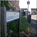
Ensbury Park: Ashburton Gardens
Modern infill housing off Beswick Avenue, it is not shown on the 1:25,000 mapping yet but it dates from the 1990s or possibly just 1980s.
The sign is a modern one, from 2010-15 when the borough introduced this more modern, abstract emblem rather than the traditional town coat of arms.
This is photo no.16 of a series of 451 in my coronavirus lockdown walking project:
See https://www.geograph.org.uk/article/My-2020-Coronavirus-Lockdown-walking-project for the complete set of photos.
Image: © Chris Downer
Taken: 13 Apr 2020
0.03 miles
2
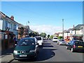
Bournemouth : Beswick Avenue
Beswick Avenue is a residential street
Image: © Lewis Clarke
Taken: 25 May 2008
0.05 miles
4
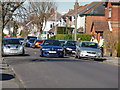
Bournemouth : Beswick Avenue
A car driving along Beswich Avenue, and some police officers are having a chat with a resident.
Image: © Lewis Clarke
Taken: 8 Mar 2010
0.05 miles
5
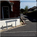
Ensbury Park: George Close
A very modern infill cul-de-sac off Beswick Avenue, George Close contains some university student accommodation. Many original houses in this neck of the woods have also become student houses; it is an ideal location a 15-minute or so walk to the main campus of Bournemouth University and the Arts University.
The road sign is a nonstandard one which has, therefore, presumably been installed by the developers rather than the council.
This is photo no.157 of a series of 453 in my coronavirus lockdown walking project:
See https://www.geograph.org.uk/article/My-2020-Coronavirus-Lockdown-walking-project for the complete set of photos.
Image: © Chris Downer
Taken: 19 Apr 2020
0.05 miles
6
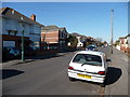
Bournemouth : Beswick Avenue
Beswick Avenue which leads towards Columbia Road.
Image: © Lewis Clarke
Taken: 8 Mar 2010
0.06 miles
7
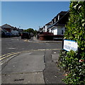
Ensbury Park: Kinsbourne Avenue
Looking across the midway crossroads of this two-segment road, the junction with Beswick Avenue. It typifies the housing in this area, 1930s-50s houses with a few stretches of bungalows here and there.
The sign is a modern one, from 2010-15 when this more modern, abstract emblem rather than the traditional town coat of arms as the working logo of the council.
This is photo no.229 of a series of 453 in my coronavirus lockdown walking project:
See https://www.geograph.org.uk/article/My-2020-Coronavirus-Lockdown-walking-project for the complete set of photos.
Image: © Chris Downer
Taken: 19 Apr 2020
0.06 miles
8
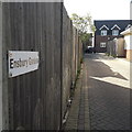
Ensbury Park: Ensbury Gardens
A modern infill development behind Ensbury Avenue. The virtually unbroken line of houses is split into three in terms of address and access, with the more or less identical Hartmoor Gardens and Glenmoor Gardens adjacent to the south.
The sign is small and nonstandard and, therefore, presumably erected by the developer rather than the council.
This is photo no.135 of a series of 453 in my coronavirus lockdown walking project:
See https://www.geograph.org.uk/article/My-2020-Coronavirus-Lockdown-walking-project for the complete set of photos.
Image: © Chris Downer
Taken: 13 Apr 2020
0.07 miles
10
Ensbury Park: Hartmoor Gardens
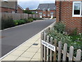
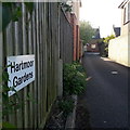
A modern infill development behind Ensbury Avenue. The virtually unbroken line of houses is split into three in terms of address and access, with the more or less identical Glenmoor Gardens to the south and Ensbury Gardens to the north.
The sign is small and nonstandard and, therefore, presumably erected by the developer rather than the council.
This is photo no.181 of a series of 453 in my coronavirus lockdown walking project:
See https://www.geograph.org.uk/article/My-2020-Coronavirus-Lockdown-walking-project for the complete set of photos.
Image: © Chris Downer
Taken: 13 Apr 2020
0.08 miles