IMAGES TAKEN NEAR TO
Camellia Gardens, BOURNEMOUTH, BH10 4FJ

Introduction

This page details the photographs taken nearby to Camellia Gardens, BH10 4FJ by members of the Geograph project.

The Geograph project started in 2005 with the aim of publishing, organising and preserving representative images for every square kilometre of Great Britain, Ireland and the Isle of Man.

There are currently over 7.5m images from over14,400 individuals and you can help contribute to the project by visiting https://www.geograph.org.uk

Image Map


Images are licensed for reuse under creativecommons.org/licenses/by-sa/2.0
Notes
  • Clicking on the map will re-center to the selected point.
  • The higher the marker number, the further away the image location is from the centre of the postcode.

Image Listing (159 Images Found)

Images are licensed for reuse under creativecommons.org/licenses/by-sa/2.0
  • ...
Image
Details
Distance
1
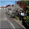
Ensbury Park: Camellia Gardens
A modern infill development of bungalows off Dawn Close, itself a no-through road. The sign is a modern one, from 2010-15 when this more modern, abstract emblem rather than the traditional town coat of arms as the working logo of the council. This is photo no.58 of a series of 453 in my coronavirus lockdown walking project: See https://www.geograph.org.uk/article/My-2020-Coronavirus-Lockdown-walking-project for the complete set of photos.
Image: © Chris Downer Taken: 14 Apr 2020
0.03 miles
2
Ensbury Park: footpath N18 leaves footpath N08
One of Bournemouth's longest public footpaths, heading some 1200m to Boundary Road, goes into the distance on the right, while a short footpath to Singleton Drive bears left. Another footpath, N17 to Columbian Way, heads a sharper left at the same point. See: Image for the path behind us; Image for the next stretch of footpath N08 ahead; and Image for a view slightly round to the left, showing paths N18 and N17. These linked photos contain further links to pictures along the whole length of each route.
Image: © Chris Downer Taken: 3 Jul 2016
0.04 miles
3
Bournemouth : Columbia Road & Road Junctions
Two roads lead off here from Columbia Road - Glenville Road and Howeth Road.
Image: © Lewis Clarke Taken: 8 Mar 2010
0.04 miles
4
Ensbury Park
This is the junction of Howeth Rd , Columbia Rd and Glenville Avenue as viewed from Howeth Rd. The detached houses are on Columbia Rd the east-west route through Ensbury Park.
Image: © Nigel Mykura Taken: 23 Apr 2011
0.04 miles
5
Bournemouth : Columbia Road
A police car on Columbia Road, and some traffic lights near a bus stop.
Image: © Lewis Clarke Taken: 8 Mar 2010
0.04 miles
6
Ensbury Park: footpath N08 leaves Columbia Road
A long public footpath, varying in characteristics, is seen here at its northern end, between a large detached house and a council terrace. This is the more urban end of the path - it runs through the Slades Farm estate, then across a large recreation ground before abutting woods to arrive at Boundary Road. At 1195 metres in length, it is one of the longest public rights of way in Bournemouth. See Image for the next view along the path, and links to further pictures along its entire length. (Also partly in shot is another footpath, numbered N35, running along the frontages of the houses to the left - see Image)
Image: © Chris Downer Taken: 3 Jul 2016
0.04 miles
7
Dawn Close, Bournemouth
Image: © Alex McGregor Taken: 18 Oct 2010
0.05 miles
8
Ensbury Park: footpaths N17 and N18 meet footpath N08
A picture from the same spot as Image, but looking a bit further round to the left, to show the second diverging path, N17, to the left leading to Columbian Way. See Image for a view towards us on path N17, and Image for a picture looking this way from path N18.
Image: © Chris Downer Taken: 3 Jul 2016
0.05 miles
9
Make way for more flats
This site, on the corner of Columbia, Howeth and Glenville Roads, has been occupied by a boarded up old bakery and a perfectly good adjoining house for many years. Along with most disused sites in Bournemouth and Poole (not to mention many perfectly good houses!), it is being redeveloped as blocks of flats. They are everywhere!
Image: © Chris Downer Taken: 23 Jun 2007
0.05 miles
10
Ensbury Park: footpath N17 heads west
This short public footpath leads from the end of Columbian Way (just to our left - Image) and runs along the edge of a small green to meet with the more major footpath N08 in the distance. See Image for a view from that end.
Image: © Chris Downer Taken: 3 Jul 2016
0.05 miles
  • ...