Ensbury Park: footpath N08 leaves Columbia Road
Introduction
The photograph on this page of Ensbury Park: footpath N08 leaves Columbia Road by Chris Downer as part of the Geograph project.
The Geograph project started in 2005 with the aim of publishing, organising and preserving representative images for every square kilometre of Great Britain, Ireland and the Isle of Man.

There are currently over 7.5m images from over 14,400 individuals and you can help contribute to the project by visiting https://www.geograph.org.uk
Ensbury Park: footpath N08 leaves Columbia Road
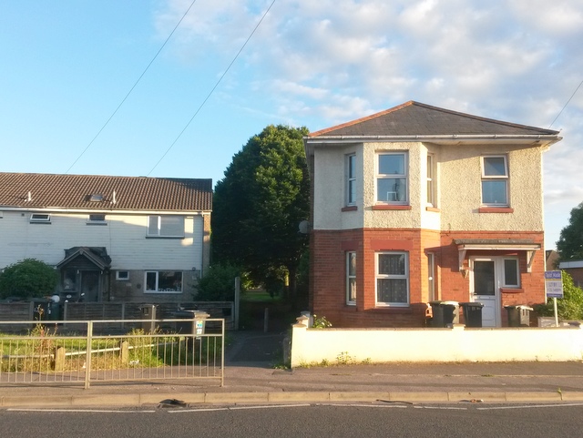
Image: © Chris Downer Taken: 3 Jul 2016
A long public footpath, varying in characteristics, is seen here at its northern end, between a large detached house and a council terrace. This is the more urban end of the path - it runs through the Slades Farm estate, then across a large recreation ground before abutting woods to arrive at Boundary Road. At 1195 metres in length, it is one of the longest public rights of way in Bournemouth. See Image for the next view along the path, and links to further pictures along its entire length. (Also partly in shot is another footpath, numbered N35, running along the frontages of the houses to the left - see Image)
Images are licensed for reuse under creativecommons.org/licenses/by-sa/2.0
Image Location
Latitude
50.751944
Longitude
-1.896468