
IMAGES TAKEN NEAR TO
Priestley Road, BOURNEMOUTH, BH10 4AU
Introduction
This page details the photographs taken nearby to Priestley Road, BH10 4AU by members of the Geograph project.
The Geograph project started in 2005 with the aim of publishing, organising and preserving representative images for every square kilometre of Great Britain, Ireland and the Isle of Man.

There are currently over 7.5m images from over14,400 individuals and you can help contribute to the project by visiting https://www.geograph.org.uk
Image Map
Images are licensed for reuse under creativecommons.org/licenses/by-sa/2.0
Notes
- Clicking on the map will re-center to the selected point.
- The higher the marker number, the further away the image location is from the centre of the postcode.
Image Listing (86 Images Found)
Images are licensed for reuse under creativecommons.org/licenses/by-sa/2.0
Image
Details
Distance
1

Ensbury Park: Montrose Drive
A cul-de-sac of bungalows off Priestley Road.
The sign tells us that the road isn't modern: it looks like an ordinary 1980s sign mounted on tubular steel (such as the one at Image), but careful scrutiny will tell us that the lettering and black border is embossed in the metalwork and not put on adhesively like the more modern variety. This makes it one of the older, perhaps 1960s, nameplates.
This is photo no.277 of a series of 451 in my coronavirus lockdown walking project:
See https://www.geograph.org.uk/article/My-2020-Coronavirus-Lockdown-walking-project for the complete set of photos.
Image: © Chris Downer
Taken: 15 Apr 2020
0.05 miles
2
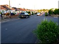
Kingsbere Avenue
View east along the bungalow lined estate road. The road going off on the right is Noel Rd. Kingsbere is the fictitious name Thomas hardy gave to the town of Bere Regis in his novel Tess of the Durbervilles.
Image: © Nigel Mykura
Taken: 23 Apr 2011
0.06 miles
3
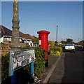
Ensbury Park: Kingsbere Avenue
A steepish road descending from the main Kinson Road to Priestley Road, lined with bungalows typical of Ensbury Park and with a low hedge between pavement and roadway.
The sign is of a design that became prevalent in Bournemouth around 1990 and was in use for most of that decade. Many are starting to look a bit shabby now, the white surface often starting to peel as here, though the blue border has seen little fading unlike many.
This is photo no.223 of a series of 453 in my coronavirus lockdown walking project:
See https://www.geograph.org.uk/article/My-2020-Coronavirus-Lockdown-walking-project for the complete set of photos.
Image: © Chris Downer
Taken: 14 Apr 2020
0.08 miles
4
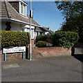
Ensbury Park: Columbia Trees Lane
This rather rurally named road runs between St. Margaret's Road and Talbot Rise, and has dwellings on only one side: they face the allotments which are on our right. It consists of bungalows, as is the norm for all the roads in the vicinity.
The sign is of a design that became prevalent in Bournemouth around 1990 and was in use for most of that decade. Many are starting to look a bit shabby now, but this one is in good condition without any peeling white or fading blue.
The additional arrow is because this is a 90º turn in the carriageway, rather than a junction as such. St. Margaret's Road that is to our left, with no other roads to right or behind.
This is photo no.78 of a series of 453 in my coronavirus lockdown walking project:
See https://www.geograph.org.uk/article/My-2020-Coronavirus-Lockdown-walking-project for the complete set of photos.
Image: © Chris Downer
Taken: 15 Apr 2020
0.08 miles
5
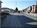
Bournemouth : Columbia Road
Looking down Columbia Road towards Kinson Road, and on the left a road junction with Priestley Road.
Image: © Lewis Clarke
Taken: 8 Mar 2010
0.09 miles
6
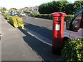
East Howe: postbox № BH10 322, Kingsbere Avenue
This George V-reign postbox is situated in the bungalowy area of East Howe, in Kingsbere Avenue. It has the shadow of a lamppost running right down it at the moment.
Image: © Chris Downer
Taken: 3 Jul 2008
0.10 miles
7
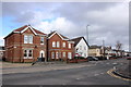
Houses on Columbia Rd
These detached red brick houses are on Columbia Rd close to the junction with Priestly Rd
Image: © Nigel Mykura
Taken: 7 Feb 2019
0.10 miles
8

Ensbury Park: footpath N06 from Nicholas Gardens
This public footpath is a very short one - we can clearly see the end ahead. It forms a short cut to Furze Bank Lane, which crosses Nicholas Gardens just past the tree.
An electricity substation is positioned at the far corner of the intervening triangle.
See Image for a view along the path from the far end, including links to further photos along Furze Bank Lane in both directions.
Image: © Chris Downer
Taken: 9 Jul 2016
0.10 miles
9
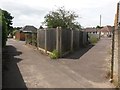
Ensbury Park: footpath N06 joins Furze Bank Lane
We stand on the middle of three segments of Furze Bank Lane - each is a public footpath. The southern segment is N04, this middle segment N05, and the northern segment N07.
Here, we see an offshoot of it, footpath N06 (right), cutting a corner from Nicholas Gardens. An electricity substation stands in the intervening triangle.
See:
Image for the next view along Furze Bank Lane, ahead-left;
Image for the next view along the lane behind us; and
Image for a view along path N06 (ahead-right) from the far end.
Image: © Chris Downer
Taken: 9 Jul 2016
0.10 miles
10
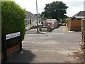
Ensbury Park: Furze Bank Lane crosses Nicholas Gardens
We stand on the middle of three segments of Furze Bank Lane - each is a public footpath. The southern segment (ahead) is N04, this middle segment N05, and the northern segment N07.
The very recent sign spells Furze Bank as one word, Furzebank.
See: Image for the next view along the path ahead, and Image for the next view behind us (explaining what happened to the number N06).
Image: © Chris Downer
Taken: 9 Jul 2016
0.10 miles