IMAGES TAKEN NEAR TO
Tyersal Lane, BRADFORD, BD4 0RF
Introduction
This page details the photographs taken nearby to Tyersal Lane, BD4 0RF by members of the Geograph project.
The Geograph project started in 2005 with the aim of publishing, organising and preserving representative images for every square kilometre of Great Britain, Ireland and the Isle of Man.

There are currently over 7.5m images from over14,400 individuals and you can help contribute to the project by visiting https://www.geograph.org.uk
Image Map
Images are licensed for reuse under creativecommons.org/licenses/by-sa/2.0
Notes
- Clicking on the map will re-center to the selected point.
- The higher the marker number, the further away the image location is from the centre of the postcode.
Image Listing (21 Images Found)
Images are licensed for reuse under creativecommons.org/licenses/by-sa/2.0
Image
Details
Distance
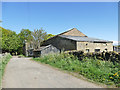
3
Bench Mark Black Hey Farm Tyersal Lane
Bench mark cut as described https://www.bench-marks.org.uk/bm122645
Wider location of benchmark https://www.geograph.org.uk/photo/6490551
Image: © OfficeOfPudseyBMs
Taken: 15 May 2020
0.01 miles
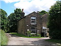
4
Bench Mark Black Hey Farm Tyersal Lane
Wider view of location of bench mark at Black Hey Farm as described https://www.bench-marks.org.uk/bm122645
Close up photograph https://www.geograph.org.uk/photo/6490546
Image: © OfficeOfPudseyBMs
Taken: 15 May 2020
0.01 miles
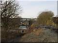
6
Remains of the railway bridge over Tyersal Lane
Image: © John Slater
Taken: 18 Jun 2012
0.04 miles
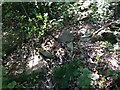
7
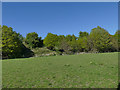
Railway embankment near Tyersal
The embankment (now heavily wooded) carried the GNR railway line (see shared description).
Image: © Stephen Craven
Taken: 2 May 2020
0.05 miles
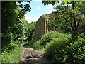
8
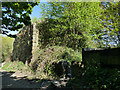
Old railway bridge abutment, Tyersal Lane
There was once a skew bridge here carrying the two tracks of the GNR's Pudsey and Low Moor branch (see shared description).
Image: © Stephen Craven
Taken: 2 May 2020
0.05 miles
9
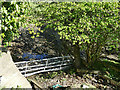
Small beck by Tyersal Lane
The beck is named as The Syke on larger scale maps. It now forms the outflow of a small fishing lake, and was almost dried up after several weeks of dry weather.
Image: © Stephen Craven
Taken: 2 May 2020
0.12 miles
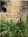
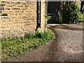
10
Location of Rivet Benchmark, Tyersal Lane
Wide-angle view of the location of the gatepost with rivet. The gatepost is lying on its side in the centre of the image. See image http://www.geograph.org.uk/photo/6885115 for a close-up view of rivet benchmark.
Image: © OfficeOfPudseyBMs
Taken: 1 Jul 2021
0.13 miles