IMAGES TAKEN NEAR TO
Marchbank Road, BRADFORD, BD3 8QQ
Introduction
This page details the photographs taken nearby to Marchbank Road, BD3 8QQ by members of the Geograph project.
The Geograph project started in 2005 with the aim of publishing, organising and preserving representative images for every square kilometre of Great Britain, Ireland and the Isle of Man.

There are currently over 7.5m images from over14,400 individuals and you can help contribute to the project by visiting https://www.geograph.org.uk
Image Map
Images are licensed for reuse under creativecommons.org/licenses/by-sa/2.0
Notes
- Clicking on the map will re-center to the selected point.
- The higher the marker number, the further away the image location is from the centre of the postcode.
Image Listing (114 Images Found)
Images are licensed for reuse under creativecommons.org/licenses/by-sa/2.0
Image
Details
Distance
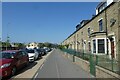
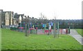
2
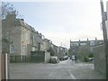
Moor Park Close - off Killinghall Road
Image: © Betty Longbottom
Taken: 23 Nov 2008
0.05 miles
4
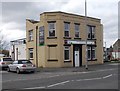
Madrassah Jamiah Farooqiah - Barkerend Road
Image: © Betty Longbottom
Taken: 30 Apr 2018
0.08 miles
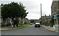
5
CS1 near Moor Park Close
CS1, the Leeds-Bradford cycle superhighway running along part of Barkerend Road.
Image: © DS Pugh
Taken: 26 May 2023
0.08 miles
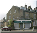
7
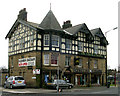
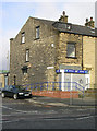
Coach & Horses, Barkerend Road, Bradford
Now a Kashmiri Bazaar
Image: © Betty Longbottom
Taken: 10 Mar 2007
0.09 miles
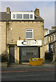
10
Lloyds Pharmacy - Chelmsford Terrace
Image: © Betty Longbottom
Taken: 8 Nov 2009
0.09 miles