IMAGES TAKEN NEAR TO
Studley Road, BRADFORD, BD3 0NQ
Introduction
This page details the photographs taken nearby to Studley Road, BD3 0NQ by members of the Geograph project.
The Geograph project started in 2005 with the aim of publishing, organising and preserving representative images for every square kilometre of Great Britain, Ireland and the Isle of Man.

There are currently over 7.5m images from over14,400 individuals and you can help contribute to the project by visiting https://www.geograph.org.uk
Image Map (Loading...)


Getting Data...Please wait
Leaflet Map data © OpenStreetMap
Images are licensed for reuse under creativecommons.org/licenses/by-sa/2.0
Notes
- Clicking on the map will re-center to the selected point.
- The higher the marker number, the further away the image location is from the centre of the postcode.
Image Listing (116 Images Found)
Images are licensed for reuse under creativecommons.org/licenses/by-sa/2.0
Image
Details
Distance
3
OS Rivet Benchmark, Queens Road/Bolton Road Junction
This is on the top of a low wall at the junction of Queens Road & Bolton Road. Details at http://www.bench-marks.org.uk/bm85009
Image: © Stephen Armstrong
Taken: 28 May 2017
0.04 miles
4
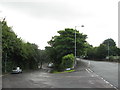
Junction of Queens Road & Bolton Road
There is an OS Rivet Benchmark on the low wall, to the right of the road nameplate. Image
Image: © Stephen Armstrong
Taken: 28 May 2017
0.04 miles
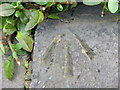
5
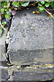
Benchmark on low wall at Queen's Road / Bolton Road junction
Ordnance Survey rivet benchmark described on the Bench Mark Database at www.bench-marks.org.uk/bm85009
Image: © Luke Shaw
Taken: 2 Sep 2017
0.04 miles
7
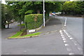
Junction of Bolton Road and Queen's Road
There is an Ordnance Survey benchmark Image on the top stone of the wall right of the 'Queens Road' name sign
Image: © Luke Shaw
Taken: 2 Sep 2017
0.06 miles
8
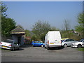
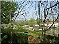
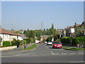
Queen's Road - from near Allotments
Image: © Betty Longbottom
Taken: 18 Apr 2011
0.07 miles
9
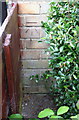
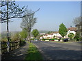
Benchmark on No.1 Queen's Avenue
Ordnance Survey cut mark benchmark described on the Bench Mark Database at www.bench-marks.org.uk/bm89059
Image: © Luke Shaw
Taken: 2 Sep 2017
0.07 miles
10
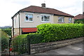
Nos. 1 & 3 Queen's Avenue
There is an Ordnance Survey benchmark Image on the side of the left hand house at its back corner
Image: © Luke Shaw
Taken: 2 Sep 2017
0.07 miles