IMAGES TAKEN NEAR TO
Renshaw Street, BRADFORD, BD10 8PH
Introduction
This page details the photographs taken nearby to Renshaw Street, BD10 8PH by members of the Geograph project.
The Geograph project started in 2005 with the aim of publishing, organising and preserving representative images for every square kilometre of Great Britain, Ireland and the Isle of Man.

There are currently over 7.5m images from over14,400 individuals and you can help contribute to the project by visiting https://www.geograph.org.uk
Image Map
Images are licensed for reuse under creativecommons.org/licenses/by-sa/2.0
Notes
- Clicking on the map will re-center to the selected point.
- The higher the marker number, the further away the image location is from the centre of the postcode.
Image Listing (122 Images Found)
Images are licensed for reuse under creativecommons.org/licenses/by-sa/2.0
Image
Details
Distance
1
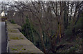
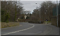
Route of a disused railway
A disused railway that used to run between Bradford and Shipley via Idle seen from the bridge carrying Leeds Road (A657) over it.
Image: © habiloid
Taken: 22 Feb 2020
0.01 miles
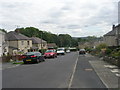
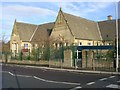
2
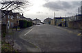
Renshaw Street
The back of Thackley Primary School is on the right.
Image: © habiloid
Taken: 22 Feb 2020
0.02 miles
4
Leeds Road railway bridge, Thackley
The railway line through Thackley closed in 1968 but the main road still makes a dog-leg detour over the bridge. See Image for a view from the other side.
Image: © Stephen Craven
Taken: 5 Apr 2021
0.02 miles
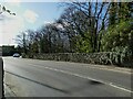
5
Leeds Road (A657) crossing a disused railway
Leeds Road makes a chicane over a bridge crossing the route of a disused railway that used to run between Bradford and Shipley via Idle.
Image: © habiloid
Taken: 22 Feb 2020
0.03 miles
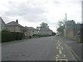
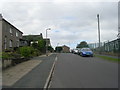
6
Harehill Road - viewed from Renshaw Street
Image: © Betty Longbottom
Taken: 24 Aug 2011
0.03 miles
7
Houses on Leeds Road, Thackley
At the time I took this photo I labelled it "old vicarage" but I can't see a sign to that effect in the picture, nor is it labelled as such on any map I can find, so that may be a mistake.
Image: © Stephen Craven
Taken: 5 Apr 2021
0.04 miles
8
Harehill Road - viewed from Renshaw Street
Image: © Betty Longbottom
Taken: 24 Aug 2011
0.04 miles
9
Thackley Primary School - Town Lane
Image: © Betty Longbottom
Taken: 13 Nov 2007
0.05 miles
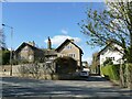
10
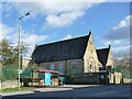
Thackley Primary School
The original buildings on Town Lane; the site also includes more modern buildings behind these.
Image: © Stephen Craven
Taken: 5 Apr 2021
0.06 miles