IMAGES TAKEN NEAR TO
Smith Street, NELSON, BB9 9QZ
Introduction
This page details the photographs taken nearby to Smith Street, BB9 9QZ by members of the Geograph project.
The Geograph project started in 2005 with the aim of publishing, organising and preserving representative images for every square kilometre of Great Britain, Ireland and the Isle of Man.

There are currently over 7.5m images from over14,400 individuals and you can help contribute to the project by visiting https://www.geograph.org.uk
Image Map
Images are licensed for reuse under creativecommons.org/licenses/by-sa/2.0
Notes
- Clicking on the map will re-center to the selected point.
- The higher the marker number, the further away the image location is from the centre of the postcode.
Image Listing (35 Images Found)
Images are licensed for reuse under creativecommons.org/licenses/by-sa/2.0
Image
Details
Distance
1
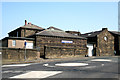
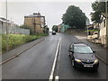
Nelson Old Brass Band Club
Usually just known as Nelson Club and housed in what appear to be former school premises. The mini-roundabout forms the junction between Netherfield Road and Barkerhouse Road.
Image: © Dr Neil Clifton
Taken: 19 Mar 2009
0.05 miles
2
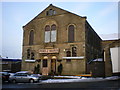
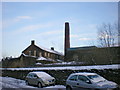
Baptist Church, Nelson, Lancashire
Although on the map supplied with the Geograph website, this church appears to be to the north of the 380 grid line, accurate maps show it to be fractionally to the south of this line, so it is in square 8637, not 8638. To judge from the outside, it is an active and robust church and will not 'go under' as so many nonconformist (and Anglican) churches have, in this area.
Image: © Dr Neil Clifton
Taken: 19 Mar 2009
0.08 miles
7
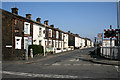
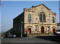
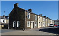
Chapel Street, Nelson, Lancashire
Chapel Street is a long street which runs parallel to the railway, and crosses Barkerhouse Road at about its mid-point, from where this photograph is taken, looking north-eastwards. The houses are numbers 94 and upwards, evens (to 144 at the far end).
Image: © Dr Neil Clifton
Taken: 19 Mar 2009
0.14 miles
8
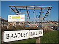
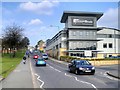
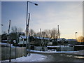
Bradley Youth Hub, Leeds Road, Nelson
Construction of a new Youth Centre on Leeds Road in Nelson, Lancashire.
Image: © Richard Dwyer
Taken: 12 Oct 2010
0.17 miles