Baptist Church, Nelson, Lancashire
Introduction
The photograph on this page of Baptist Church, Nelson, Lancashire by Dr Neil Clifton as part of the Geograph project.
The Geograph project started in 2005 with the aim of publishing, organising and preserving representative images for every square kilometre of Great Britain, Ireland and the Isle of Man.

There are currently over 7.5m images from over 14,400 individuals and you can help contribute to the project by visiting https://www.geograph.org.uk
Baptist Church, Nelson, Lancashire
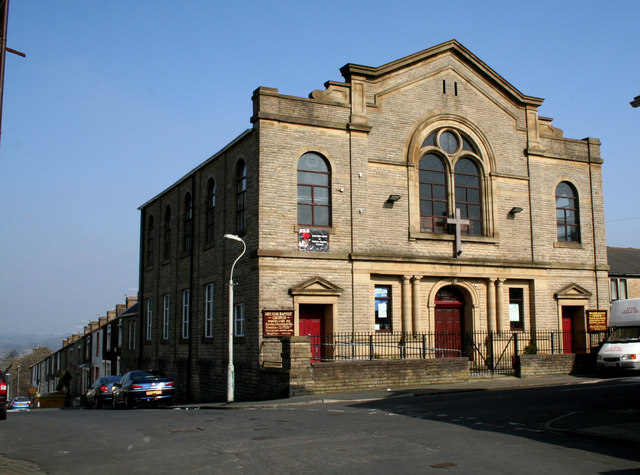
Image: © Dr Neil Clifton Taken: 19 Mar 2009
Although on the map supplied with the Geograph website, this church appears to be to the north of the 380 grid line, accurate maps show it to be fractionally to the south of this line, so it is in square 8637, not 8638. To judge from the outside, it is an active and robust church and will not 'go under' as so many nonconformist (and Anglican) churches have, in this area.
Images are licensed for reuse under creativecommons.org/licenses/by-sa/2.0
Image Location
Latitude
53.837628
Longitude
-2.204199