IMAGES TAKEN NEAR TO
Hereford Street, NELSON, BB9 7JA
Introduction
This page details the photographs taken nearby to Hereford Street, BB9 7JA by members of the Geograph project.
The Geograph project started in 2005 with the aim of publishing, organising and preserving representative images for every square kilometre of Great Britain, Ireland and the Isle of Man.

There are currently over 7.5m images from over14,400 individuals and you can help contribute to the project by visiting https://www.geograph.org.uk
Image Map
Images are licensed for reuse under creativecommons.org/licenses/by-sa/2.0
Notes
- Clicking on the map will re-center to the selected point.
- The higher the marker number, the further away the image location is from the centre of the postcode.
Image Listing (204 Images Found)
Images are licensed for reuse under creativecommons.org/licenses/by-sa/2.0
Image
Details
Distance
1
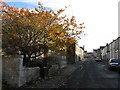
Macleod Street, Nelson
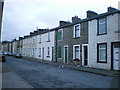
The vast majority of houses on this street are awaiting demolition. A young hornbeam, growing wild in what was once someone's front garden, adds a touch of autumn colour to the otherwise dismal prospect.
Image: © Dr Neil Clifton
Taken: 7 Nov 2008
0.01 miles
2
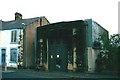
Nelson - Every Street
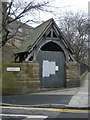
Electricity sub-station c.1900
Image: © Alan Longbottom
Taken: 13 Aug 2007
0.06 miles
3
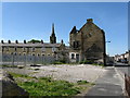
Remains of former presbytery, Nelson
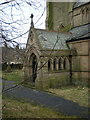
At the junction of Every Street and Macleod Street. Viewed looking south along Every Street. In the 1960s a concrete church, believed to be Roman Catholic, stood alongside the presbytery in Macleod Street. The waste ground immediately in front of the camera was occupied by a school.
Image: © Dr Neil Clifton
Taken: 9 Jun 2008
0.06 miles
4
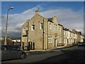
Pendle Enterprise Haven, Every Street
The former Water Office on Every Street has been nicely restored as small offices.
Image: © Dr Neil Clifton
Taken: 7 Nov 2008
0.06 miles
5

Every Street, Nelson
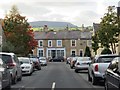
Every Street is a very long street which runs parallel to the main Manchester Road (A56). Years ago it was used as a 'rat run' but that is no longer possible as through access has been blocked. This photograph is taken looking northeast from the junction with Macleod Street. The building in shadow on the right is the ruined presbytery.
Image: © Dr Neil Clifton
Taken: 7 Nov 2008
0.06 miles
6
The Eastern Touch, "Eastern House" 29-37 Macleod Street, Nelson, Lancashire BB9 7HE
Image: © Robert Wade
Taken: 29 Jun 2011
0.06 miles