Remains of former presbytery, Nelson
Introduction
The photograph on this page of Remains of former presbytery, Nelson by Dr Neil Clifton as part of the Geograph project.
The Geograph project started in 2005 with the aim of publishing, organising and preserving representative images for every square kilometre of Great Britain, Ireland and the Isle of Man.

There are currently over 7.5m images from over 14,400 individuals and you can help contribute to the project by visiting https://www.geograph.org.uk
Remains of former presbytery, Nelson
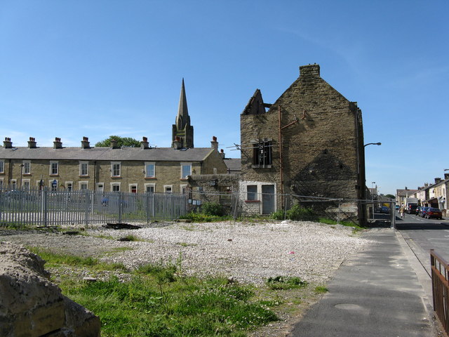
Image: © Dr Neil Clifton Taken: 9 Jun 2008
At the junction of Every Street and Macleod Street. Viewed looking south along Every Street. In the 1960s a concrete church, believed to be Roman Catholic, stood alongside the presbytery in Macleod Street. The waste ground immediately in front of the camera was occupied by a school.
Images are licensed for reuse under creativecommons.org/licenses/by-sa/2.0
Image Location
Latitude
53.835352
Longitude
-2.220295