
IMAGES TAKEN NEAR TO
Pinnock Drive, CLITHEROE, BB7 2RX
Introduction
This page details the photographs taken nearby to Pinnock Drive, BB7 2RX by members of the Geograph project.
The Geograph project started in 2005 with the aim of publishing, organising and preserving representative images for every square kilometre of Great Britain, Ireland and the Isle of Man.

There are currently over 7.5m images from over14,400 individuals and you can help contribute to the project by visiting https://www.geograph.org.uk
Image Map
Images are licensed for reuse under creativecommons.org/licenses/by-sa/2.0
Notes
- Clicking on the map will re-center to the selected point.
- The higher the marker number, the further away the image location is from the centre of the postcode.
Image Listing (30 Images Found)
Images are licensed for reuse under creativecommons.org/licenses/by-sa/2.0
Image
Details
Distance
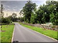
2
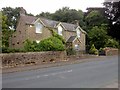
Vale View Cottage, Waddington Road
Dated 1900 above the entrance porch.
Image: © David Dixon
Taken: 16 Aug 2015
0.13 miles
3

View of Clitheroe from Waddow Hall
Image: © Alexander P Kapp
Taken: 26 Dec 2010
0.14 miles
4
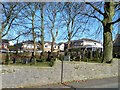
Quiet neighbours for the houses in Tucker Hill
Cemetery on the north side of Waddington Road, Clitheroe.
Image: © Christine Johnstone
Taken: 12 Mar 2013
0.14 miles


7
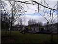
Clitheroe Cemetery
The Waddington Road Cemetery in Clitheroe is the only council owned burial area in the Ribble Valley. The cemetery services provide for traditional burials, Muslim burials, woodland burials and the burial of cremated remains.
Image: © Patrick
Taken: 13 Mar 2010
0.16 miles
8
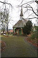
Disused Cemetery Chapel on Waddington Road
Image: © David Long
Taken: 2 Feb 2010
0.17 miles
9
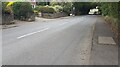
B6478 heading south passing houses Meadfoot and Lynmoor
Ordnance Survey records indicate that a benchmark was levelled at 71.133m above Newlyn Datum in 1960 on the roadside wall near the entrances to the houses
Image: © Roger Templeman
Taken: 13 Jul 2024
0.17 miles
10

Elizabeth II postbox on Eastham Street, Clitheroe
Image: © JThomas
Taken: 1 Oct 2016
0.19 miles