
IMAGES TAKEN NEAR TO
Higher Standen Drive, CLITHEROE, BB7 1FT
Introduction
This page details the photographs taken nearby to Higher Standen Drive, BB7 1FT by members of the Geograph project.
The Geograph project started in 2005 with the aim of publishing, organising and preserving representative images for every square kilometre of Great Britain, Ireland and the Isle of Man.

There are currently over 7.5m images from over14,400 individuals and you can help contribute to the project by visiting https://www.geograph.org.uk
Image Map
Images are licensed for reuse under creativecommons.org/licenses/by-sa/2.0
Notes
- Clicking on the map will re-center to the selected point.
- The higher the marker number, the further away the image location is from the centre of the postcode.
Image Listing (5 Images Found)
Images are licensed for reuse under creativecommons.org/licenses/by-sa/2.0
Image
Details
Distance
1
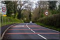
Pendle Road
Pendle Road entering Clitheroe.
Image: © Peter McDermott
Taken: 4 May 2015
0.14 miles
2
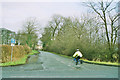
Four Lane Ends
Looking NE along the old A59, now bypassed and turned into a quiet route for cyclists and walkers.
Image: © Mike and Kirsty Grundy
Taken: 4 Jan 2006
0.17 miles
3

Old Guide Stone by Four Lane Ends, Clitheroe parish
Stone post by the UC road, in parish of Clitheroe (Ribble Valley District), Four Lane Ends, North angle of junction with Pendle Road.
Inscription once read:-
: (Clitheroe / 1) : : (Gisburn / 8) :
Carved bench mark on West face.
Surveyed
Milestone Society National ID: LA_XCLE
Image: © Milestone Society
Taken: Unknown
0.19 miles
4
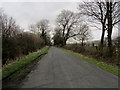
The old road to Worston
Now only a dead end, and the preserve of walkers, cyclists and the odd stray motor vehicle.
It used to run onto Worston, but its course has since been disrupted due to the construction of the Clitheroe by pass in the 1970's.
Image: © Chris Heaton
Taken: 7 Feb 2013
0.22 miles
5
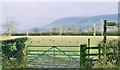
Crows in a Field
Stile and gate on the old Clitheroe bypass, now bypassed. Pendle beyond
Image: © Mike and Kirsty Grundy
Taken: 4 Jan 2006
0.24 miles