
IMAGES TAKEN NEAR TO
Billinge End Road, BLACKBURN, BB2 6PY
Introduction
This page details the photographs taken nearby to Billinge End Road, BB2 6PY by members of the Geograph project.
The Geograph project started in 2005 with the aim of publishing, organising and preserving representative images for every square kilometre of Great Britain, Ireland and the Isle of Man.

There are currently over 7.5m images from over14,400 individuals and you can help contribute to the project by visiting https://www.geograph.org.uk
Image Map
Images are licensed for reuse under creativecommons.org/licenses/by-sa/2.0
Notes
- Clicking on the map will re-center to the selected point.
- The higher the marker number, the further away the image location is from the centre of the postcode.
Image Listing (16 Images Found)
Images are licensed for reuse under creativecommons.org/licenses/by-sa/2.0
Image
Details
Distance
3
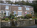
Billinge Side or Freezeland Row
A row of cottages along Billinge End Road, most likely built for quarrymen working on Billinge Hill in the 19th century.
The row is called Billinge Side on modern Ordnance Survey maps, though the original name was Freezeland Row, Freezeland being something of a local name for parts along this road between here and Pleasington village.
Image: © Greum
Taken: 4 Jun 2023
0.14 miles
4
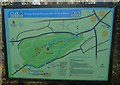
Cycle tracks information board, Billinge Hill
An information board showing details of mountain bike trails on Billinge Hill west of Blackburn.
Image: © Greum
Taken: 22 Sep 2016
0.14 miles
5
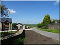
Woodgates Road
Woodgates Road is a road off Billinge End Road. Cracking views over towards Mellor are to be had in this vicinity.
Image: © Greum
Taken: 27 May 2023
0.15 miles
6
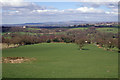
Field below Meins road
The house in the middle distance on the left is Stanley House Image, with the fells of Bowland on the horizon.
Image: © Mr T
Taken: 20 Mar 2007
0.16 miles
7
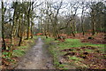
Path in Billinge Wood
The top of Billinge Hill is covered by this wood and there is a large network of paths.
Image: © Bill Boaden
Taken: 17 Mar 2012
0.16 miles
8
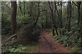
Footpath descending Billinge Hill
The hill is totally covered by woodland
Image: © Chris Heaton
Taken: 8 Sep 2019
0.17 miles
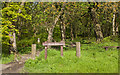
10
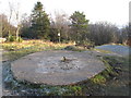
Billinge Hill
Done many times out running while staying on Redlam Road, Blackburn. Revisit in cool frosty afternoon, top is now crossed by mountain bike trails.
Name: Billinge Hill
Hill number: 5326
Height: 245m / 804ft
Area: 36: Lancashire, Cheshire & the Southern Pennines
Class: Hu
Grid ref: SD 65732 28191
Summit feature: circular concrete plinth
Drop: 117m
Col: 128m SD713304
Image: © Rude Health
Taken: 29 Jan 2011
0.18 miles