
IMAGES TAKEN NEAR TO
South Horrington Village, WELLS, BA5 3WN
Introduction
This page details the photographs taken nearby to BA5 3WN by members of the Geograph project.
The Geograph project started in 2005 with the aim of publishing, organising and preserving representative images for every square kilometre of Great Britain, Ireland and the Isle of Man.

There are currently over 7.5m images from over14,400 individuals and you can help contribute to the project by visiting https://www.geograph.org.uk
Image Map
Images are licensed for reuse under creativecommons.org/licenses/by-sa/2.0
Notes
- Clicking on the map will re-center to the selected point.
- The higher the marker number, the further away the image location is from the centre of the postcode.
Image Listing (274 Images Found)
Images are licensed for reuse under creativecommons.org/licenses/by-sa/2.0
Image
Details
Distance
1

A glimpse of the past
The old Priory Mill has used the local streams since the eleventh century, grinding wheat for bread. Its history is almost unbroken, with its water wheels working until a storm in the 1960s tore it down. Since then it has been operated as a warehouse and now a stained glass conservation group. With such a rich site, the present occupiers have allowed an occasional glimpse at some of the original workings.
Image: © Neil Owen
Taken: 12 Jul 2026
0.04 miles
2
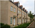
St Andrew's Walk, Wells
This row of terraced houses was constructed 2 years ago on a former industrial site (Sheldon Jones Engineering). St Andrew's Walk links Princes street with West street.
Image: © Sharon Loxton
Taken: 6 Oct 2007
0.05 miles
3
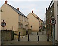
New development in West Street
There was a time when it was possible to drive from Tucker St. to Priory Rd. via West street (a bit of a 'rat run'). Evidently that is no longer possible. The buildings on the left are classic brownfield development. They stand on a site formerly occupied by Sheldon Jones Engineering.
Image: © Sharon Loxton
Taken: 6 Oct 2007
0.05 miles
4
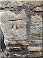
Ordnance Survey Bench Mark
This mark is located on the Priory Mills, West Street, Wells. These marks were used by Ordnance Survey for mapping purposes.
Image
Image: © V1ncenze
Taken: 8 Aug 2021
0.05 miles
5
Tucker Street benchmark
A cutmark, as listed in the Benchmark Database: http://www.bench-marks.org.uk/bm58656 , in Tucker Street. See Image] for a wider view.
Image: © Neil Owen
Taken: 24 Jun 2014
0.05 miles
6
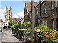
Tucker Street
With St Cuthbert's in the background. A benchmark has been cut into the short wall by the telephone pole - see Image
Image: © Neil Owen
Taken: 24 Jun 2014
0.05 miles
7
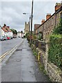
Tucker Street, Wells
View along Tucker Street, Wells. The wall also has an Ordnance Survey bench mark.
Image
Image: © V1ncenze
Taken: 8 Aug 2021
0.05 miles
8
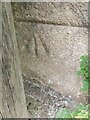
Ordnance Survey Bench Mark
This mark is located on a wall that runs along Tucker Street, Wells. These marks were used by Ordnance Survey for mapping purposes.
Image
Image: © V1ncenze
Taken: 8 Aug 2021
0.05 miles
9
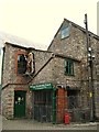
Wells Trading Post - West Street
Well's Trading Post says it is housed in an historic 11th Century Mill. For more information - http://www.wellstradingpost.com/index.html
Image: © Sharon Loxton
Taken: 6 Oct 2007
0.05 miles
10
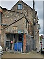
Priory Mills, West Street, Wells
Priory Mills, West Street, Wells. This building also has an Ordnance Survey bench mark.
Image
Image: © V1ncenze
Taken: 8 Aug 2021
0.05 miles