
IMAGES TAKEN NEAR TO
Hawkers Lane, WELLS, BA5 3JJ
Introduction
This page details the photographs taken nearby to Hawkers Lane, BA5 3JJ by members of the Geograph project.
The Geograph project started in 2005 with the aim of publishing, organising and preserving representative images for every square kilometre of Great Britain, Ireland and the Isle of Man.

There are currently over 7.5m images from over14,400 individuals and you can help contribute to the project by visiting https://www.geograph.org.uk
Image Map
Images are licensed for reuse under creativecommons.org/licenses/by-sa/2.0
Notes
- Clicking on the map will re-center to the selected point.
- The higher the marker number, the further away the image location is from the centre of the postcode.
Image Listing (13 Images Found)
Images are licensed for reuse under creativecommons.org/licenses/by-sa/2.0
Image
Details
Distance
1
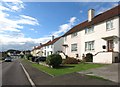
Churchill Road, Wells
As England's smallest city, Wells doesn't have much in the way of sprawling suburbs. What suburbs there are extend not much more than 1km to the east and west of the city centre, and look pretty much the way suburbs always do.
Image: © Des Blenkinsopp
Taken: 26 Aug 2014
0.12 miles
2
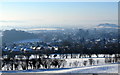
Winter view over Wells
Looking down on Wells in the snow. The large structure in the centre of Wells is the cathedral. Just to the left in front is the steeple of St Thomas' church in East Wells, and behind is the tower of St Cuthbert's church. Hay hill can be seen on the right of the photo. Taken from the footpath that leads from the Bristol road to Beryl Lane.
Image: © Sharon Loxton
Taken: 25 Dec 2010
0.16 miles
3
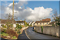
Hawker's Lane
Lane with mixed age housing on the edge of Wells.
Image: © Ian Capper
Taken: 11 Feb 2020
0.17 miles
4

Beryl
Small gothic revival style mansion by the architect Benjamin Ferrey in 1838, built for local lawyer Edward Davis. It is now a small hotel, opened in 1982.
Image: © Ian Capper
Taken: 11 Feb 2020
0.18 miles
5
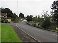
Hawker's Lane, Wells
Looking to the northeast from the corner of Bath Road. The Paray Road http://www.geograph.org.uk/photo/5139255 is on the left.
Image: © Jaggery
Taken: 27 Sep 2016
0.18 miles
6
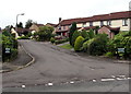
Paray Drive, Wells
From Hawker's Lane, Paray Drive leads to Dodd Avenue.
Paray Drive was named to celebrate the twinning of Wells with Paray-Le-Monial (France) in 1979.
Image: © Jaggery
Taken: 27 Sep 2016
0.21 miles
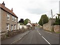
8
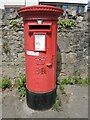
Postbox on the B3139
A fairly modern version, with priority for NHS. Box number BA5 15.
Image: © Neil Owen
Taken: 26 May 2021
0.21 miles
9
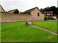
Plaque recording the naming of Paray Drive, Wells
The plaque is on a boulder on the corner of Bath Road and Hawker's Lane.
Image: © Jaggery
Taken: 27 Sep 2016
0.22 miles
10
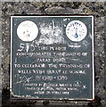
Paray Drive naming plaque detail, Wells
Located here, http://www.geograph.org.uk/photo/5139267 the plaque records that nearby Paray Drive http://www.geograph.org.uk/photo/5139255 was named to celebrate the twinning of Wells with Paray Le Monial.
Image: © Jaggery
Taken: 27 Sep 2016
0.22 miles