Paray Drive naming plaque detail, Wells
Introduction
The photograph on this page of Paray Drive naming plaque detail, Wells by Jaggery as part of the Geograph project.
The Geograph project started in 2005 with the aim of publishing, organising and preserving representative images for every square kilometre of Great Britain, Ireland and the Isle of Man.

There are currently over 7.5m images from over 14,400 individuals and you can help contribute to the project by visiting https://www.geograph.org.uk
Paray Drive naming plaque detail, Wells
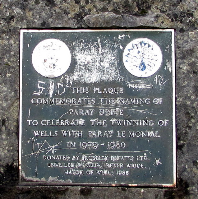
Image: © Jaggery Taken: 27 Sep 2016
Located here, http://www.geograph.org.uk/photo/5139267 the plaque records that nearby Paray Drive http://www.geograph.org.uk/photo/5139255 was named to celebrate the twinning of Wells with Paray Le Monial.
Images are licensed for reuse under creativecommons.org/licenses/by-sa/2.0
Image Location
Latitude
51.213641
Longitude
-2.634179