IMAGES TAKEN NEAR TO
Stoberry Avenue, WELLS, BA5 2TF
Introduction
This page details the photographs taken nearby to Stoberry Avenue, BA5 2TF by members of the Geograph project.
The Geograph project started in 2005 with the aim of publishing, organising and preserving representative images for every square kilometre of Great Britain, Ireland and the Isle of Man.

There are currently over 7.5m images from over14,400 individuals and you can help contribute to the project by visiting https://www.geograph.org.uk
Image Map
Images are licensed for reuse under creativecommons.org/licenses/by-sa/2.0
Notes
- Clicking on the map will re-center to the selected point.
- The higher the marker number, the further away the image location is from the centre of the postcode.
Image Listing (226 Images Found)
Images are licensed for reuse under creativecommons.org/licenses/by-sa/2.0
Image
Details
Distance
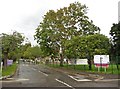
2
North Road, Wells
This bare oak tree offers little shelter from the steady rain. The road passes a couple of old stone outbuildings as it passes Stoberry County Junior School, off to the right.
Image: © Derek Harper
Taken: 22 Feb 2010
0.08 miles
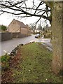
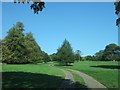
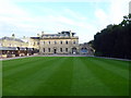
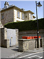
3
Entrance to Storberry Park
Storberry Park is a mansion and grounds on the edge of Wells. The house is now a country house hotel.
Image: © Des Blenkinsopp
Taken: 23 Aug 2014
0.09 miles
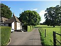
4
Bishop Bekynton's Chapel, Vicars' Close, Wells
At the end of Vicars' Close, dating from 1470-5.
Image: © Philip Pankhurst
Taken: 21 Sep 2006
0.10 miles
7
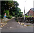
Little Entry, Wells
Little Entry is a lane on the northeast side of North Road.
Signs show No footway for 500 yds and Unsuitable for heavy goods vehicles.
Image: © Jaggery
Taken: 27 Sep 2016
0.13 miles
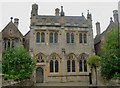
8
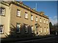
The Cedars, The Trinity, Wells
The Cedars, an eighteenth century house, is one of a number of houses on this road which are part of Wells Cathedral School.
Image: © Philip Halling
Taken: 17 Jan 2010
0.13 miles
9
College Road
At the end of the road where it meets The Liberty is a benchmark on the blockwork. See Image] for a closer look.
Image: © Neil Owen
Taken: 4 Jul 2013
0.13 miles
10
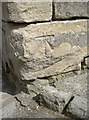
Crumbling benchmark
A cutmark on the corner of College Road and The Liberty, slowly being erased. See http://www.bench-marks.org.uk/bm50742 for the entry in the Benchmark Database and Image] for a wider view.
Image: © Neil Owen
Taken: 4 Jul 2013
0.13 miles