
IMAGES TAKEN NEAR TO
Welsford Close, WELLS, BA5 2JE
Introduction
This page details the photographs taken nearby to Welsford Close, BA5 2JE by members of the Geograph project.
The Geograph project started in 2005 with the aim of publishing, organising and preserving representative images for every square kilometre of Great Britain, Ireland and the Isle of Man.

There are currently over 7.5m images from over14,400 individuals and you can help contribute to the project by visiting https://www.geograph.org.uk
Image Map
Images are licensed for reuse under creativecommons.org/licenses/by-sa/2.0
Notes
- Clicking on the map will re-center to the selected point.
- The higher the marker number, the further away the image location is from the centre of the postcode.
Image Listing (15 Images Found)
Images are licensed for reuse under creativecommons.org/licenses/by-sa/2.0
Image
Details
Distance
1
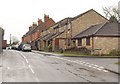
Wookey Hole Road, Wells
New housing by the junction with Singleton Court on the right, followed by a Victorian red brick terrace. Hidden on the left is the junction with Ash Lane.
Image: © Derek Harper
Taken: 22 Feb 2010
0.06 miles
2
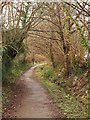
Goodymoor Lane, Wells
With trees alongside and a small watercourse (heading for the River Axe) on the right, footpath WS 17/37 follows the line of an old lane through the modern Goodymoor estate on the northwest side of Wells. On the left are the rears of properties on Goodymoor Avenue.
Image: © Derek Harper
Taken: 22 Feb 2010
0.11 miles
3
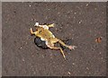
Squashed frog, Wells
Apologies for this picture, which was the best exposed I took all day. What is really tragic is the way she seems to be lifting a front leg to ask "if you don't mind, could I just cross the road?" The road in question was St Cuthbert Way at its junction with St Cuthbert Avenue.
Image: © Derek Harper
Taken: 22 Feb 2010
0.13 miles

5
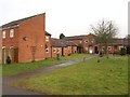
Housing on Lethbridge Road, Wells
Forming a little quadrangle of eight connected properties at the point where footpath WS 17/37 heads off towards Wells Leisure Centre.
Image: © Derek Harper
Taken: 22 Feb 2010
0.16 miles
6

Lethbridge Road play area
A small place in among the new houses, one of several little spaces for little ones.
Image: © Neil Owen
Taken: 9 Jul 2025
0.17 miles
7
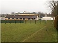
Wells Leisure Centre
Built on a recreation ground, the centre has a swimming pool, sports hall, spa, fitness centre, plus cafe, creche and meeting rooms.
Image: © Derek Harper
Taken: 22 Feb 2010
0.17 miles
8
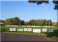
Adverts by the Rugby Field
A scene at Wells Rugby Club.
Image: © Des Blenkinsopp
Taken: 23 Aug 2014
0.18 miles
9

Formerly CRS Building Supplies
The banner advises the business has moved to Southover.
Image: © Robin Webster
Taken: 15 Apr 2017
0.18 miles
10

Wells rugby ground
Wells Rugby Football Club was founded in 1876 and has played at various grounds: Gallows Close, Knapp Hill, East Horrington, the Bath & West Show Ground, and Sheldons. However, with Wells being developed in this area, the club has played here at Charter Way since 1983.
Image: © Neil Owen
Taken: 9 Jul 2025
0.19 miles