
IMAGES TAKEN NEAR TO
Bath Road, WELLS, BA5 2DW
Introduction
This page details the photographs taken nearby to Bath Road, BA5 2DW by members of the Geograph project.
The Geograph project started in 2005 with the aim of publishing, organising and preserving representative images for every square kilometre of Great Britain, Ireland and the Isle of Man.

There are currently over 7.5m images from over14,400 individuals and you can help contribute to the project by visiting https://www.geograph.org.uk
Image Map
Images are licensed for reuse under creativecommons.org/licenses/by-sa/2.0
Notes
- Clicking on the map will re-center to the selected point.
- The higher the marker number, the further away the image location is from the centre of the postcode.
Image Listing (94 Images Found)
Images are licensed for reuse under creativecommons.org/licenses/by-sa/2.0
Image
Details
Distance
1

East side of The Mews, Bath Road, Wells
21st century housing set back from the south side of Bath Road.
The nameplate on the left shows THE MEWS/AD 2012/Private Road.
Image: © Jaggery
Taken: 27 Sep 2016
0.01 miles
2
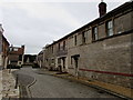
West side of The Mews, Bath Road, Wells
21st century housing set back from the south side of Bath Road.
A nameplate behind the camera shows THE MEWS/AD 2012/Private Road.
Image: © Jaggery
Taken: 27 Sep 2016
0.01 miles
3
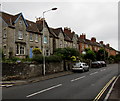
Western end of Bath Road, Wells
The B3139 St Thomas Street behind the camera is the B3139 Bath Road ahead.
Image: © Jaggery
Taken: 27 Sep 2016
0.02 miles
4

From stone to brick, Bath Road, Wells
Change of house type on the north side of the B3139 Bath Road.
Image: © Jaggery
Taken: 27 Sep 2016
0.03 miles
5
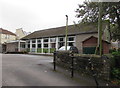
St Thomas Church Hall Bungalow, Wells
Set back from the south side of St Thomas Street, to the east of the Church of St Thomas. http://www.geograph.org.uk/photo/5218396
Image: © Jaggery
Taken: 27 Sep 2016
0.03 miles
7
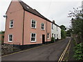
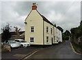
Beryl Cottages, Beryl Lane, Wells
At the southern end of Beryl Lane, viewed from the corner of Bath Road.
Image: © Jaggery
Taken: 27 Sep 2016
0.04 miles
8
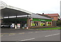
Budgens, Wells
Budgens minimarket and post office viewed across Bath Road.
Image: © Jaggery
Taken: 27 Sep 2016
0.04 miles
9
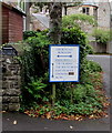
Blue-edged directions sign near St Thomas Street, Wells
Left for Church Hall Bungalow, http://www.geograph.org.uk/photo/5218497 right for the Parish Office,
ahead for the Vicarage, the Old Vicarage, the East Vicarage and Goldacre.
Image: © Jaggery
Taken: 27 Sep 2016
0.04 miles
10
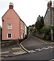
Southern end of Beryl Lane, Wells
Beryl Lane extends northwards from Bath Road for 550 metres.
Image: © Jaggery
Taken: 27 Sep 2016
0.05 miles