
IMAGES TAKEN NEAR TO
Beadon Drive, WELLS, BA5 1GA
Introduction
This page details the photographs taken nearby to Beadon Drive, BA5 1GA by members of the Geograph project.
The Geograph project started in 2005 with the aim of publishing, organising and preserving representative images for every square kilometre of Great Britain, Ireland and the Isle of Man.

There are currently over 7.5m images from over14,400 individuals and you can help contribute to the project by visiting https://www.geograph.org.uk
Image Map
Images are licensed for reuse under creativecommons.org/licenses/by-sa/2.0
Notes
- Clicking on the map will re-center to the selected point.
- The higher the marker number, the further away the image location is from the centre of the postcode.
Image Listing (56 Images Found)
Images are licensed for reuse under creativecommons.org/licenses/by-sa/2.0
Image
Details
Distance
1
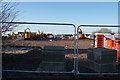
New housing development on the edge of Wells
This is part of the Vicarage Fields site, which involves significant housing expansion to the south of Wells.
Image: © Bill Boaden
Taken: 29 Dec 2016
0.03 miles
2
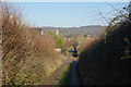
Gate Lane
A farm track heading towards Wells. The tower ahead belongs to St Cuthbert's.
Image: © Bill Boaden
Taken: 29 Dec 2016
0.06 miles
3

Keeping the Keward Brook in balance
The new estate surrounding the Keward Brook has some provision for mitigating a flood. This small balancing pond will help waters breaching into Wand Road. Beyond is a small play area for the children.
Image: © Neil Owen
Taken: 14 Dec 2022
0.08 miles
4
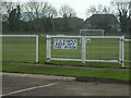
Simple game, football
A simple sign on the ground.
Image: © Neil Owen
Taken: 14 Dec 2022
0.12 miles
5

Pathways at the edge of the housing
This part of Wells used to be home to a large Cow and Gate dairy factory before being redeveloped into housing. The edge of the estate is bounded by Gate Lane and some landscaped tree-planting. Ben Knowle hill lies in the distance.
Image: © Neil Owen
Taken: 14 Dec 2022
0.12 miles
6
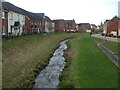
Between Bagot Walk and Eden Drive
The Keward Brook was slightly re-routed as the housing estate was built, resulting in the present landscaping.
Image: © Neil Owen
Taken: 14 Dec 2022
0.12 miles
7
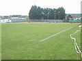
Wells recreation ground
Looking over the pitches to the tennis courts. In earlier times there was a dairy factory behind them.
Image: © Neil Owen
Taken: 14 Dec 2022
0.12 miles
8
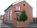
The Old Pumphouse
Although now converted into business use, the pumphouse is not that old.
Image: © Neil Owen
Taken: 14 Dec 2022
0.12 miles
9
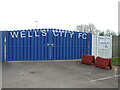
Home of Wells City F.C.
The club formed in the summer of 1890 and moved to the current home in Rowdens Road in 1893/94 season.
Image: © Neil Owen
Taken: 14 Dec 2022
0.13 miles
10
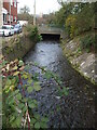
The Keward Brook from Rowden Road bridge
The brook flows from the Bishop's Palace and out to the southwest of the city.
Image: © Neil Owen
Taken: 14 Dec 2022
0.13 miles